

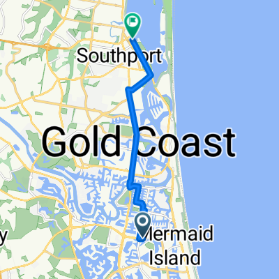
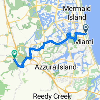
Robina to Spit
A cycling route starting in Clear Island Waters, Queensland, Australia.
Overview
About this route
- 2 h 5 min
- Duration
- 42 km
- Distance
- 137 m
- Ascent
- 140 m
- Descent
- 20.3 km/h
- Avg. speed
- ---
- Max. altitude

Route quality
Waytypes & surfaces along the route
Waytypes
Road
18.5 km
(44 %)
Quiet road
8 km
(19 %)
Surfaces
Paved
41.6 km
(99 %)
Asphalt
21.4 km
(51 %)
Paved (undefined)
19.3 km
(46 %)
Continue with Bikemap
Use, edit, or download this cycling route
You would like to ride Robina to Spit or customize it for your own trip? Here is what you can do with this Bikemap route:
Free features
- Save this route as favorite or in collections
- Copy & plan your own version of this route
- Sync your route with Garmin or Wahoo
Premium features
Free trial for 3 days, or one-time payment. More about Bikemap Premium.
- Navigate this route on iOS & Android
- Export a GPX / KML file of this route
- Create your custom printout (try it for free)
- Download this route for offline navigation
Discover more Premium features.
Get Bikemap PremiumFrom our community
Other popular routes starting in Clear Island Waters
 Plumosa Ct, Mermaid Waters ferry rd southport
- Distance
- 10.8 km
- Ascent
- 19 m
- Descent
- 17 m
- Location
- Clear Island Waters, Queensland, Australia
 The Bigger Loop
- Distance
- 200 km
- Ascent
- 1,005 m
- Descent
- 1,004 m
- Location
- Clear Island Waters, Queensland, Australia
 Robina to Spit
- Distance
- 42 km
- Ascent
- 137 m
- Descent
- 140 m
- Location
- Clear Island Waters, Queensland, Australia
 Albatross Av, Mermaid Beach to Mudgeeraba
- Distance
- 14.4 km
- Ascent
- 97 m
- Descent
- 97 m
- Location
- Clear Island Waters, Queensland, Australia
 Robina.Nerang.Mudgeeraba 45km
- Distance
- 45.4 km
- Ascent
- 345 m
- Descent
- 344 m
- Location
- Clear Island Waters, Queensland, Australia
 Broadbeach Tallebugera Tomowin Tumbulgum Teed & return
- Distance
- 91.2 km
- Ascent
- 684 m
- Descent
- 685 m
- Location
- Clear Island Waters, Queensland, Australia
 Plumosa Ct, Mermaid Waters to Birmingham Rd, Carrara
- Distance
- 19.4 km
- Ascent
- 110 m
- Descent
- 109 m
- Location
- Clear Island Waters, Queensland, Australia
 northview to tugun hungrys
- Distance
- 16.1 km
- Ascent
- 309 m
- Descent
- 319 m
- Location
- Clear Island Waters, Queensland, Australia
Open it in the app