

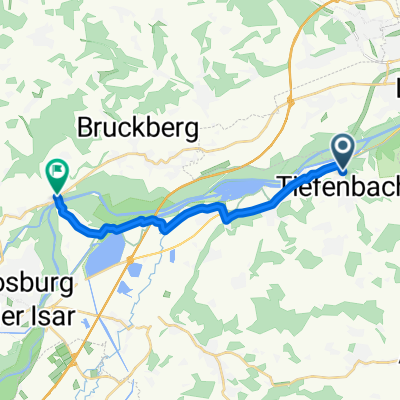
Tiefenbach süd
A cycling route starting in Tiefenbach, Bavaria, Germany.
Overview
About this route
Beautiful route for road cyclists mainly on quiet country roads. The route is hilly
- -:--
- Duration
- 42.7 km
- Distance
- 363 m
- Ascent
- 365 m
- Descent
- ---
- Avg. speed
- ---
- Max. altitude
Route quality
Waytypes & surfaces along the route
Waytypes
Road
14.5 km
(34 %)
Quiet road
7.7 km
(18 %)
Surfaces
Paved
38.4 km
(90 %)
Asphalt
38.4 km
(90 %)
Undefined
4.3 km
(10 %)
Continue with Bikemap
Use, edit, or download this cycling route
You would like to ride Tiefenbach süd or customize it for your own trip? Here is what you can do with this Bikemap route:
Free features
- Save this route as favorite or in collections
- Copy & plan your own version of this route
- Sync your route with Garmin or Wahoo
Premium features
Free trial for 3 days, or one-time payment. More about Bikemap Premium.
- Navigate this route on iOS & Android
- Export a GPX / KML file of this route
- Create your custom printout (try it for free)
- Download this route for offline navigation
Discover more Premium features.
Get Bikemap PremiumFrom our community
Other popular routes starting in Tiefenbach
 Tiefenbach - Wartenberg 1
- Distance
- 52.6 km
- Ascent
- 367 m
- Descent
- 372 m
- Location
- Tiefenbach, Bavaria, Germany
 obergolding-Binsham-Tiefenbach-Heinzelwinkl-Viecht-Neuhof-Steffing-Tiefenbach
- Distance
- 18.3 km
- Ascent
- 389 m
- Descent
- 390 m
- Location
- Tiefenbach, Bavaria, Germany
 Tiefenbach süd
- Distance
- 42.7 km
- Ascent
- 363 m
- Descent
- 365 m
- Location
- Tiefenbach, Bavaria, Germany
 SC 53_04_kleine Hallertaurunde
- Distance
- 67.5 km
- Ascent
- 399 m
- Descent
- 339 m
- Location
- Tiefenbach, Bavaria, Germany
 Tiefenbach
- Distance
- 11.8 km
- Ascent
- 103 m
- Descent
- 103 m
- Location
- Tiefenbach, Bavaria, Germany
 Rundstrecke Moosburg
- Distance
- 13.2 km
- Ascent
- 71 m
- Descent
- 68 m
- Location
- Tiefenbach, Bavaria, Germany
 SC 53_06_lange Runde durchs Erdinger Holzland
- Distance
- 187.2 km
- Ascent
- 1,527 m
- Descent
- 1,515 m
- Location
- Tiefenbach, Bavaria, Germany
 Pfingstersatz
- Distance
- 276.1 km
- Ascent
- 380 m
- Descent
- 378 m
- Location
- Tiefenbach, Bavaria, Germany
Open it in the app