Rollhofen über die Wolfshöhe nach Germersberg
- 6.6 km
- 41 m
- 19 m
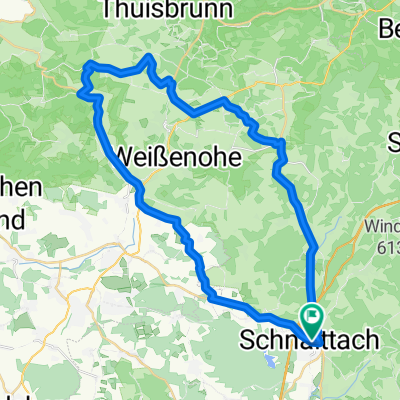
- Schnaittach, Bavaria, Germany
A cycling route starting in Schnaittach, Bavaria, Germany.
Overview
created this 5 years ago
Route quality
Road
17.2 km
50 %
Quiet road
6.9 km
20 %
Paved
25.9 km
(75 %)
Asphalt
25.2 km
73 %
Paved (undefined)
0.7 km
2 %
Undefined
8.6 km
25 %
Continue with Bikemap
You would like to ride Fritz-Schnelbögl-Straße 14, Schnaittach nach Amag-Hilpert-Straße 20, Pegnitz or customize it for your own trip? Here is what you can do with this Bikemap route:
Free trial for 3 days, or one-time payment. More about Bikemap Premium.
Discover more Premium features.
Get Bikemap PremiumFrom our community
Open it in the app