

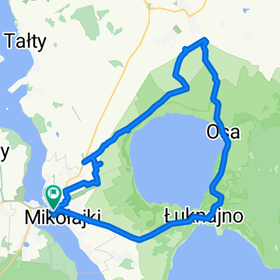
Masuren Tag 5
A cycling route starting in Mikołajki, Warmian-Masurian Voivodeship, Poland.
Overview
About this route
From Zelwagi to the cycling resort Piaski. With a detour to Popielno to see the Tarpan.
- -:--
- Duration
- 57.6 km
- Distance
- 207 m
- Ascent
- 208 m
- Descent
- ---
- Avg. speed
- ---
- Max. altitude
Continue with Bikemap
Use, edit, or download this cycling route
You would like to ride Masuren Tag 5 or customize it for your own trip? Here is what you can do with this Bikemap route:
Free features
- Save this route as favorite or in collections
- Copy & plan your own version of this route
- Sync your route with Garmin or Wahoo
Premium features
Free trial for 3 days, or one-time payment. More about Bikemap Premium.
- Navigate this route on iOS & Android
- Export a GPX / KML file of this route
- Create your custom printout (try it for free)
- Download this route for offline navigation
Discover more Premium features.
Get Bikemap PremiumFrom our community
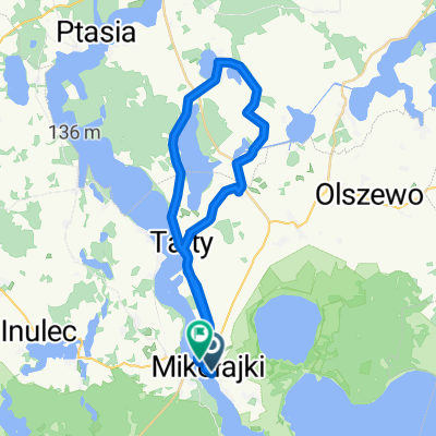
Other popular routes starting in Mikołajki
 pl Wolności, Mikołajki do J Kajki, Mikołajki
- Distance
- 20.3 km
- Ascent
- 107 m
- Descent
- 106 m
- Location
- Mikołajki, Warmian-Masurian Voivodeship, Poland
 Mazury_2017TrzeciEtap
- Distance
- 99.9 km
- Ascent
- 187 m
- Descent
- 186 m
- Location
- Mikołajki, Warmian-Masurian Voivodeship, Poland
 Papieża Jana Pawła II 7, Mikołajki to Kolejowa 2, Mikołajki
- Distance
- 19.7 km
- Ascent
- 76 m
- Descent
- 87 m
- Location
- Mikołajki, Warmian-Masurian Voivodeship, Poland
 Mrągowska 34, Mikołajki do Michała Kajki 118, Mikołajki
- Distance
- 30.5 km
- Ascent
- 4 m
- Descent
- 24 m
- Location
- Mikołajki, Warmian-Masurian Voivodeship, Poland
 Michała Kajki do plac Wolności
- Distance
- 31.8 km
- Ascent
- 98 m
- Descent
- 134 m
- Location
- Mikołajki, Warmian-Masurian Voivodeship, Poland
 al Spacerowa 10, Mikołajki to Szkolna 4, Mikołajki
- Distance
- 20.3 km
- Ascent
- 119 m
- Descent
- 115 m
- Location
- Mikołajki, Warmian-Masurian Voivodeship, Poland
 al Spacerowa 14, Mikołajki do al Spacerowa 14, Mikołajki
- Distance
- 40.4 km
- Ascent
- 867 m
- Descent
- 872 m
- Location
- Mikołajki, Warmian-Masurian Voivodeship, Poland
 kris
kris- Distance
- 47.2 km
- Ascent
- 206 m
- Descent
- 207 m
- Location
- Mikołajki, Warmian-Masurian Voivodeship, Poland
Open it in the app