Overview
About this route
Loop ride through Oakleigh East, bike paths and onroad
- -:--
- Duration
- 15.4 km
- Distance
- 77 m
- Ascent
- 80 m
- Descent
- ---
- Avg. speed
- ---
- Max. altitude
Part of
Judy's Routes
5 stages
Route quality
Waytypes & surfaces along the route
Waytypes
Quiet road
9.6 km
(62 %)
Cycleway
4.3 km
(28 %)
Surfaces
Paved
13.3 km
(86 %)
Paved (undefined)
5.4 km
(35 %)
Concrete
4.3 km
(28 %)
Continue with Bikemap
Use, edit, or download this cycling route
You would like to ride 5km Radius - Bike Route 3 or customize it for your own trip? Here is what you can do with this Bikemap route:
Free features
- Save this route as favorite or in collections
- Copy & plan your own version of this route
- Sync your route with Garmin or Wahoo
Premium features
Free trial for 3 days, or one-time payment. More about Bikemap Premium.
- Navigate this route on iOS & Android
- Export a GPX / KML file of this route
- Create your custom printout (try it for free)
- Download this route for offline navigation
Discover more Premium features.
Get Bikemap PremiumFrom our community
Other popular routes starting in Clayton
- 5km Radius - Bike Route 3
- Distance
- 15.4 km
- Ascent
- 77 m
- Descent
- 80 m
- Location
- Clayton, Victoria, Australia
- Capital P
- Distance
- 43.2 km
- Ascent
- 310 m
- Descent
- 376 m
- Location
- Clayton, Victoria, Australia
- 50KM Loop to Mitcham
- Distance
- 48.9 km
- Ascent
- 281 m
- Descent
- 278 m
- Location
- Clayton, Victoria, Australia
- Loop to Ringwood Lake
- Distance
- 58.3 km
- Ascent
- 323 m
- Descent
- 326 m
- Location
- Clayton, Victoria, Australia
- Huntingdale Station to Moorabbin DFO
- Distance
- 8.8 km
- Ascent
- 15 m
- Descent
- 62 m
- Location
- Clayton, Victoria, Australia
- Mordialloc Freeway
- Distance
- 32.3 km
- Ascent
- 4 m
- Descent
- 25 m
- Location
- Clayton, Victoria, Australia
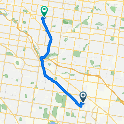
- Oakleigh Ward, Clayton to 970 Nepean Hwy, Moorabbin
- Distance
- 11.5 km
- Ascent
- 42 m
- Descent
- 73 m
- Location
- Clayton, Victoria, Australia
- Recording from November 16, 18:16
- Distance
- 26.7 km
- Ascent
- 228 m
- Descent
- 228 m
- Location
- Clayton, Victoria, Australia
Open it in the app