
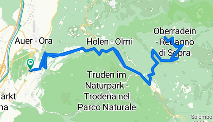
Montan-Radein-ret.
A cycling route starting in Montan, Trentino-Alto Adige, Italy.
Overview
About this route
- -:--
- Duration
- 35.4 km
- Distance
- 1,224 m
- Ascent
- 1,221 m
- Descent
- ---
- Avg. speed
- ---
- Avg. speed

Route quality
Waytypes & surfaces along the route
Waytypes
Busy road
18.7 km
(53 %)
Road
10.4 km
(29 %)
Surfaces
Paved
18.8 km
(53 %)
Unpaved
2.7 km
(8 %)
Asphalt
18.8 km
(53 %)
Gravel
1.5 km
(4 %)
Continue with Bikemap
Use, edit, or download this cycling route
You would like to ride Montan-Radein-ret. or customize it for your own trip? Here is what you can do with this Bikemap route:
Free features
- Save this route as favorite or in collections
- Copy & plan your own version of this route
- Sync your route with Garmin or Wahoo
Premium features
Free trial for 3 days, or one-time payment. More about Bikemap Premium.
- Navigate this route on iOS & Android
- Export a GPX / KML file of this route
- Create your custom printout (try it for free)
- Download this route for offline navigation
Discover more Premium features.
Get Bikemap PremiumFrom our community
Other popular routes starting in Montan
 Via Gleno, Montagna do Via Pinzano 9, Montagna
- Distance
- 45.1 km
- Ascent
- 1,446 m
- Descent
- 1,440 m
- Location
- Montan, Trentino-Alto Adige, Italy
 Auer-Cavalese
- Distance
- 33.1 km
- Ascent
- 1,342 m
- Descent
- 566 m
- Location
- Montan, Trentino-Alto Adige, Italy
 ferrovia della val di fiemme
- Distance
- 20.1 km
- Ascent
- 738 m
- Descent
- 250 m
- Location
- Montan, Trentino-Alto Adige, Italy
 Neumarkt nach San Lugano und zurück über Truden - Neumarkt nach San Lugano und zurück über Truden
- Distance
- 30.5 km
- Ascent
- 1,134 m
- Descent
- 1,136 m
- Location
- Montan, Trentino-Alto Adige, Italy
 Auer-Trient-Auer
- Distance
- 86.8 km
- Ascent
- 118 m
- Descent
- 114 m
- Location
- Montan, Trentino-Alto Adige, Italy
 Via Pinzano 9, Montagna do Via Pinzano 9, Montagna
- Distance
- 54.9 km
- Ascent
- 1,702 m
- Descent
- 1,718 m
- Location
- Montan, Trentino-Alto Adige, Italy
 Trudner Horn 2.Tag nicht alles aufgezeichnet 47km 1400 HM
- Distance
- 30.3 km
- Ascent
- 598 m
- Descent
- 1,105 m
- Location
- Montan, Trentino-Alto Adige, Italy
 MTB-Tour an der Alten Fleimstaler Bahntrasse - MTB-Tour an der Alten Fleimstaler Bahntrasse
- Distance
- 19.1 km
- Ascent
- 959 m
- Descent
- 246 m
- Location
- Montan, Trentino-Alto Adige, Italy
Open it in the app