

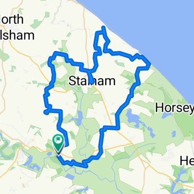
hoveton to horning
A cycling route starting in Coltishall, England, United Kingdom.
Overview
About this route
- 17 min
- Duration
- 4.9 km
- Distance
- 20 m
- Ascent
- 16 m
- Descent
- 17.3 km/h
- Avg. speed
- ---
- Max. altitude

Route quality
Waytypes & surfaces along the route
Waytypes
Quiet road
0.3 km
(6 %)
Access road
0 km
(1 %)
Continue with Bikemap
Use, edit, or download this cycling route
You would like to ride hoveton to horning or customize it for your own trip? Here is what you can do with this Bikemap route:
Free features
- Save this route as favorite or in collections
- Copy & plan your own version of this route
- Sync your route with Garmin or Wahoo
Premium features
Free trial for 3 days, or one-time payment. More about Bikemap Premium.
- Navigate this route on iOS & Android
- Export a GPX / KML file of this route
- Create your custom printout (try it for free)
- Download this route for offline navigation
Discover more Premium features.
Get Bikemap PremiumFrom our community
Other popular routes starting in Coltishall
 coltishall 7 miles
- Distance
- 11.3 km
- Ascent
- 25 m
- Descent
- 27 m
- Location
- Coltishall, England, United Kingdom
 Station Business Park, Horning Rd W, Norwich to Marriott's Way, Norwich
- Distance
- 54.4 km
- Ascent
- 260 m
- Descent
- 261 m
- Location
- Coltishall, England, United Kingdom
 Wroxham > Thorpe
- Distance
- 11 km
- Ascent
- 63 m
- Descent
- 24 m
- Location
- Coltishall, England, United Kingdom
 Lower Street, Norwich to Lower Street, Norwich
- Distance
- 58.5 km
- Ascent
- 87 m
- Descent
- 87 m
- Location
- Coltishall, England, United Kingdom
 coltishall to walcott
- Distance
- 21.3 km
- Ascent
- 37 m
- Descent
- 37 m
- Location
- Coltishall, England, United Kingdom
 Broads
- Distance
- 58.5 km
- Ascent
- 82 m
- Descent
- 80 m
- Location
- Coltishall, England, United Kingdom
 Hoveton to SeaPalling then loop
- Distance
- 46.3 km
- Ascent
- 41 m
- Descent
- 46 m
- Location
- Coltishall, England, United Kingdom
 Broads by Tandem
- Distance
- 49.6 km
- Ascent
- 38 m
- Descent
- 35 m
- Location
- Coltishall, England, United Kingdom
Open it in the app