
Muddy trip 🙂
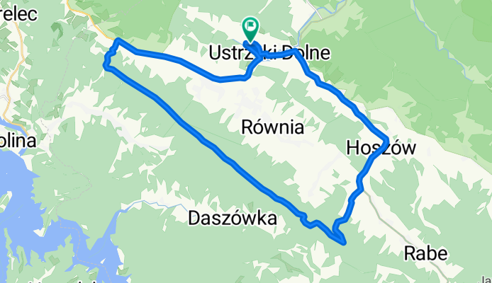
A cycling route starting in Ustrzyki Dolne, Subcarpathian Voivodeship, Poland.
Overview
About this route
- 2 h 56 min
- Duration
- 32.7 km
- Distance
- 537 m
- Ascent
- 538 m
- Descent
- 11.1 km/h
- Avg. speed
- ---
- Max. altitude

Route photos


Route quality
Waytypes & surfaces along the route
Waytypes
Busy road
14.9 km
(46 %)
Track
8.8 km
(27 %)
Surfaces
Paved
21.4 km
(66 %)
Unpaved
4.7 km
(14 %)
Asphalt
21.2 km
(65 %)
Ground
4.6 km
(14 %)
Continue with Bikemap
Use, edit, or download this cycling route
You would like to ride Muddy trip 🙂 or customize it for your own trip? Here is what you can do with this Bikemap route:
Free features
- Save this route as favorite or in collections
- Copy & plan your own version of this route
- Sync your route with Garmin or Wahoo
Premium features
Free trial for 3 days, or one-time payment. More about Bikemap Premium.
- Navigate this route on iOS & Android
- Export a GPX / KML file of this route
- Create your custom printout (try it for free)
- Download this route for offline navigation
Discover more Premium features.
Get Bikemap PremiumFrom our community
Other popular routes starting in Ustrzyki Dolne
 Ustrzyki Dln-Ropienka-Tyrawa Woloska-Olszanica-Ustrzyki Dln 🙂
- Distance
- 63.7 km
- Ascent
- 584 m
- Descent
- 592 m
- Location
- Ustrzyki Dolne, Subcarpathian Voivodeship, Poland
 Bieszczady 2015
- Distance
- 211 km
- Ascent
- 2,749 m
- Descent
- 2,764 m
- Location
- Ustrzyki Dolne, Subcarpathian Voivodeship, Poland
 Duża Pętla Bieszczadzka
- Distance
- 142.7 km
- Ascent
- 1,120 m
- Descent
- 1,120 m
- Location
- Ustrzyki Dolne, Subcarpathian Voivodeship, Poland
 D1W1 Ustrzyki Dolne - Suche rzeki
- Distance
- 60.2 km
- Ascent
- 1,612 m
- Descent
- 1,530 m
- Location
- Ustrzyki Dolne, Subcarpathian Voivodeship, Poland
 2/3 Dookoła Soliny
- Distance
- 70.1 km
- Ascent
- 1,106 m
- Descent
- 1,229 m
- Location
- Ustrzyki Dolne, Subcarpathian Voivodeship, Poland
 Polskiego Czerwonego Krzyża 52, Ustrzyki Dolne do Solina 176, Solina
- Distance
- 16.3 km
- Ascent
- 686 m
- Descent
- 745 m
- Location
- Ustrzyki Dolne, Subcarpathian Voivodeship, Poland
 Muddy trip 🙂
- Distance
- 32.7 km
- Ascent
- 537 m
- Descent
- 538 m
- Location
- Ustrzyki Dolne, Subcarpathian Voivodeship, Poland
 Solina Lake loop 🙂
- Distance
- 77.6 km
- Ascent
- 1,157 m
- Descent
- 1,156 m
- Location
- Ustrzyki Dolne, Subcarpathian Voivodeship, Poland
Open it in the app