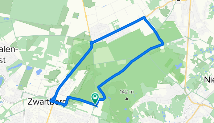
Opglabbekerzavel, Genk naar Opglabbekerzavel, Genk
A cycling route starting in As, Flemish Region, Belgium.
Overview
About this route
- 28 min
- Duration
- 12 km
- Distance
- 6 m
- Ascent
- 6 m
- Descent
- 25.7 km/h
- Avg. speed
- ---
- Max. altitude
Route quality
Waytypes & surfaces along the route
Waytypes
Cycleway
7.3 km
(61 %)
Track
1.2 km
(10 %)
Surfaces
Paved
8.5 km
(71 %)
Unpaved
1.6 km
(13 %)
Asphalt
5.3 km
(44 %)
Paved (undefined)
1.7 km
(14 %)
Continue with Bikemap
Use, edit, or download this cycling route
You would like to ride Opglabbekerzavel, Genk naar Opglabbekerzavel, Genk or customize it for your own trip? Here is what you can do with this Bikemap route:
Free features
- Save this route as favorite or in collections
- Copy & plan your own version of this route
- Sync your route with Garmin or Wahoo
Premium features
Free trial for 3 days, or one-time payment. More about Bikemap Premium.
- Navigate this route on iOS & Android
- Export a GPX / KML file of this route
- Create your custom printout (try it for free)
- Download this route for offline navigation
Discover more Premium features.
Get Bikemap PremiumFrom our community
Other popular routes starting in As
- route Anouk Deel 2
- Distance
- 16.7 km
- Ascent
- 22 m
- Descent
- 74 m
- Location
- As, Flemish Region, Belgium
- Kanne - Tongeren
- Distance
- 83.6 km
- Ascent
- 221 m
- Descent
- 221 m
- Location
- As, Flemish Region, Belgium
- B/B As - Maaseik VV Kolenspoor
- Distance
- 16.3 km
- Ascent
- 49 m
- Descent
- 100 m
- Location
- As, Flemish Region, Belgium
- 20_As_Deel_4
- Distance
- 77.2 km
- Ascent
- 114 m
- Descent
- 117 m
- Location
- As, Flemish Region, Belgium
- DiStGroen
- Distance
- 14.7 km
- Ascent
- 115 m
- Descent
- 112 m
- Location
- As, Flemish Region, Belgium
- Niel-bij-As / Maasmechelen
- Distance
- 57.5 km
- Ascent
- 117 m
- Descent
- 122 m
- Location
- As, Flemish Region, Belgium
- Thor Park Genk. Kleine wandeling.
- Distance
- 11.3 km
- Ascent
- 116 m
- Descent
- 114 m
- Location
- As, Flemish Region, Belgium
- 2020-09-09 Route
- Distance
- 53.3 km
- Ascent
- 183 m
- Descent
- 182 m
- Location
- As, Flemish Region, Belgium
Open it in the app