

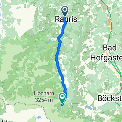
Rauris Hundsdorf - Hochalm
A cycling route starting in Rauris, Salzburg, Austria.
Overview
About this route
- -:--
- Duration
- 6 km
- Distance
- 871 m
- Ascent
- 103 m
- Descent
- ---
- Avg. speed
- ---
- Max. altitude

Continue with Bikemap
Use, edit, or download this cycling route
You would like to ride Rauris Hundsdorf - Hochalm or customize it for your own trip? Here is what you can do with this Bikemap route:
Free features
- Save this route as favorite or in collections
- Copy & plan your own version of this route
- Sync your route with Garmin or Wahoo
Premium features
Free trial for 3 days, or one-time payment. More about Bikemap Premium.
- Navigate this route on iOS & Android
- Export a GPX / KML file of this route
- Create your custom printout (try it for free)
- Download this route for offline navigation
Discover more Premium features.
Get Bikemap PremiumFrom our community
Other popular routes starting in Rauris
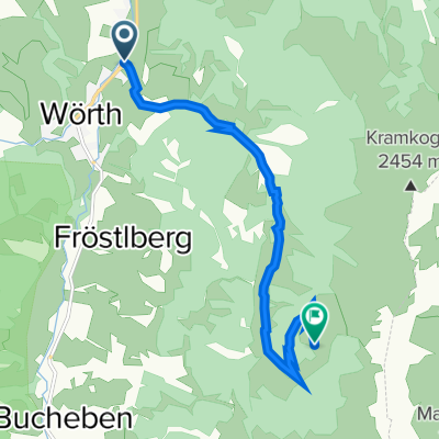
 Liftweg 4, Wörtherberg nach Seidlwinkltal - Tal der Säumer 116
- Distance
- 18 km
- Ascent
- 487 m
- Descent
- 6 m
- Location
- Rauris, Salzburg, Austria
 Rauris - Kolm Saigurn Naturfreundehaus
- Distance
- 20.6 km
- Ascent
- 702 m
- Descent
- 38 m
- Location
- Rauris, Salzburg, Austria
 Karalm
- Distance
- 8.4 km
- Ascent
- 484 m
- Descent
- 26 m
- Location
- Rauris, Salzburg, Austria
 Glockner Runde
- Distance
- 71 km
- Ascent
- 1,814 m
- Descent
- 1,810 m
- Location
- Rauris, Salzburg, Austria
 Rauris: Krotmoosalm
- Distance
- 8.1 km
- Ascent
- 852 m
- Descent
- 15 m
- Location
- Rauris, Salzburg, Austria
 Rauris Miloš3
- Distance
- 45.6 km
- Ascent
- 1,022 m
- Descent
- 1,015 m
- Location
- Rauris, Salzburg, Austria
 Kolm-Saigurn
- Distance
- 19.8 km
- Ascent
- 656 m
- Descent
- 33 m
- Location
- Rauris, Salzburg, Austria
 Kolm Saigurn
- Distance
- 0.4 km
- Ascent
- 0 m
- Descent
- 12 m
- Location
- Rauris, Salzburg, Austria
Open it in the app