Rennsteig, -Loquitztal - Taugwitztal
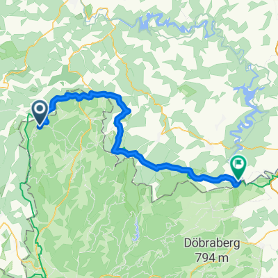
A cycling route starting in Tettau, Bavaria, Germany.
Overview
About this route
Until Steinbach slightly hilly. The B 85 descends through Ludwigsstadt to the junction to Kupferhammer. Then a gentle ascent to Ebersdorf. Then a steep climb to the Rennsteig. Short descent to Kleintettau.
- -:--
- Duration
- 25.6 km
- Distance
- 435 m
- Ascent
- 413 m
- Descent
- ---
- Avg. speed
- 725 m
- Max. altitude
Route quality
Waytypes & surfaces along the route
Waytypes
Road
6.9 km
(27 %)
Path
5.9 km
(23 %)
Surfaces
Paved
18.5 km
(72 %)
Asphalt
18.5 km
(72 %)
Undefined
7.2 km
(28 %)
Continue with Bikemap
Use, edit, or download this cycling route
You would like to ride Rennsteig, -Loquitztal - Taugwitztal or customize it for your own trip? Here is what you can do with this Bikemap route:
Free features
- Save this route as favorite or in collections
- Copy & plan your own version of this route
- Sync your route with Garmin or Wahoo
Premium features
Free trial for 3 days, or one-time payment. More about Bikemap Premium.
- Navigate this route on iOS & Android
- Export a GPX / KML file of this route
- Create your custom printout (try it for free)
- Download this route for offline navigation
Discover more Premium features.
Get Bikemap PremiumFrom our community
Other popular routes starting in Tettau
- Tettau Neuhaus Schwarzatal Saalfeld
- Distance
- 64.7 km
- Ascent
- 674 m
- Descent
- 1,082 m
- Location
- Tettau, Bavaria, Germany
- Rennsteig, -Loquitztal - Taugwitztal
- Distance
- 25.6 km
- Ascent
- 435 m
- Descent
- 413 m
- Location
- Tettau, Bavaria, Germany
- Rund um Hasenthal
- Distance
- 21.5 km
- Ascent
- 546 m
- Descent
- 523 m
- Location
- Tettau, Bavaria, Germany
- 2022-08-11 Kleintettau nach Untersiemau
- Distance
- 55.9 km
- Ascent
- 358 m
- Descent
- 694 m
- Location
- Tettau, Bavaria, Germany
- von K`tettau nach Jagsdhof-Heinersdorf
- Distance
- 33.3 km
- Ascent
- 427 m
- Descent
- 427 m
- Location
- Tettau, Bavaria, Germany
- Der Rennsteig - bayrischer Teil Schildwiese-Ziegelhütte
- Distance
- 24.7 km
- Ascent
- 346 m
- Descent
- 346 m
- Location
- Tettau, Bavaria, Germany
- 20-8-14 Vom Rennsteig nach Kronach
- Distance
- 31.7 km
- Ascent
- 19 m
- Descent
- 369 m
- Location
- Tettau, Bavaria, Germany
- RVC-Tour Talsperre Leibis ab Kalte Küche
- Distance
- 46.8 km
- Ascent
- 889 m
- Descent
- 892 m
- Location
- Tettau, Bavaria, Germany
Open it in the app