

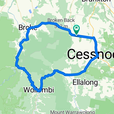
Wine Country Drive, Lovedale to 430 Wine Country Drive, Lovedale
A cycling route starting in Cessnock, New South Wales, Australia.
Overview
About this route
- 2 h 28 min
- Duration
- 20.5 km
- Distance
- 424 m
- Ascent
- 468 m
- Descent
- 8.3 km/h
- Avg. speed
- ---
- Max. altitude

Route photos


Route quality
Waytypes & surfaces along the route
Waytypes
Quiet road
9.2 km
(45 %)
Access road
5.7 km
(28 %)
Surfaces
Paved
2.5 km
(12 %)
Unpaved
8.6 km
(42 %)
Unpaved (undefined)
6.4 km
(31 %)
Asphalt
2.5 km
(12 %)
Continue with Bikemap
Use, edit, or download this cycling route
You would like to ride Wine Country Drive, Lovedale to 430 Wine Country Drive, Lovedale or customize it for your own trip? Here is what you can do with this Bikemap route:
Free features
- Save this route as favorite or in collections
- Copy & plan your own version of this route
- Sync your route with Garmin or Wahoo
Premium features
Free trial for 3 days, or one-time payment. More about Bikemap Premium.
- Navigate this route on iOS & Android
- Export a GPX / KML file of this route
- Create your custom printout (try it for free)
- Download this route for offline navigation
Discover more Premium features.
Get Bikemap PremiumFrom our community
Other popular routes starting in Cessnock
 Vincent Street 222, Cessnock to Mulbring Street 10, Aberdare
- Distance
- 1.4 km
- Ascent
- 6 m
- Descent
- 3 m
- Location
- Cessnock, New South Wales, Australia
 Wine & Ride Elfin Hill Hunter Valley
- Distance
- 28.3 km
- Ascent
- 374 m
- Descent
- 379 m
- Location
- Cessnock, New South Wales, Australia
 Harrigan's - Wollombi - Cessnock loop
- Distance
- 90.4 km
- Ascent
- 336 m
- Descent
- 336 m
- Location
- Cessnock, New South Wales, Australia
 Hunter Valley
- Distance
- 33.2 km
- Ascent
- 252 m
- Descent
- 248 m
- Location
- Cessnock, New South Wales, Australia
 Wine Country Drive, Lovedale to 430 Wine Country Drive, Lovedale
- Distance
- 20.5 km
- Ascent
- 424 m
- Descent
- 468 m
- Location
- Cessnock, New South Wales, Australia
 Hunter Valley ride
- Distance
- 36 km
- Ascent
- 274 m
- Descent
- 272 m
- Location
- Cessnock, New South Wales, Australia
 Millfield to Cessnock loop
- Distance
- 37.3 km
- Ascent
- 430 m
- Descent
- 430 m
- Location
- Cessnock, New South Wales, Australia
 Harrigan's - Cessnock - Rothbury - Hermitage Rd. loop
- Distance
- 51.7 km
- Ascent
- 307 m
- Descent
- 308 m
- Location
- Cessnock, New South Wales, Australia
Open it in the app