

USA Trip - Tag 17
A cycling route starting in North Charleston, South Carolina, United States.
Overview
About this route
Since we needed to cover some kilometers, there was another transfer stage. This time it was split into two parts.
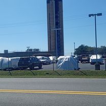
After an early morning sightseeing ride through the lovely town of Charleston, we took the Interstate 95 to Jacksonville. So just highway riding and all good. Marco was literally speeding (130 km/h).
After that, we took the A1A, which as you can see on the map, runs right along the sea and was very nice except for some areas where hotel blocks lined up closely.
We arrived in Titusville, from where we plan to head to the Kennedy Space Center tomorrow. We quickly booked accommodation today during a stop at Dunkin' Donuts with WIFI.
- -:--
- Duration
- 694.5 km
- Distance
- 120 m
- Ascent
- 118 m
- Descent
- ---
- Avg. speed
- ---
- Max. altitude

Continue with Bikemap
Use, edit, or download this cycling route
You would like to ride USA Trip - Tag 17 or customize it for your own trip? Here is what you can do with this Bikemap route:
Free features
- Save this route as favorite or in collections
- Copy & plan your own version of this route
- Split it into stages to create a multi-day tour
- Sync your route with Garmin or Wahoo
Premium features
Free trial for 3 days, or one-time payment. More about Bikemap Premium.
- Navigate this route on iOS & Android
- Export a GPX / KML file of this route
- Create your custom printout (try it for free)
- Download this route for offline navigation
Discover more Premium features.
Get Bikemap PremiumFrom our community
Other popular routes starting in North Charleston
 Centre Pointe Drive to Tanger Outlet Blvd / Hotel Rd
- Distance
- 23 km
- Ascent
- 253 m
- Descent
- 211 m
- Location
- North Charleston, South Carolina, United States
 2403 Mall Dr, North Charleston to 405 W Coleman Blvd, Mount Pleasant
- Distance
- 19.7 km
- Ascent
- 81 m
- Descent
- 82 m
- Location
- North Charleston, South Carolina, United States
 USA Trip - Tag 17
- Distance
- 694.5 km
- Ascent
- 120 m
- Descent
- 118 m
- Location
- North Charleston, South Carolina, United States
 Work
Work- Distance
- 10.9 km
- Ascent
- 83 m
- Descent
- 83 m
- Location
- North Charleston, South Carolina, United States
 Old Towne Plantation Rd, Charleston to 1500 Old Towne Rd, Charleston
- Distance
- 3.6 km
- Ascent
- 25 m
- Descent
- 24 m
- Location
- North Charleston, South Carolina, United States
 Ashley Hall Plantation Road 414, Charleston to Ashley Hall Plantation Road 78, Charleston
- Distance
- 7.8 km
- Ascent
- 29 m
- Descent
- 24 m
- Location
- North Charleston, South Carolina, United States
 60 and up
- Distance
- 53.8 km
- Ascent
- 58 m
- Descent
- 53 m
- Location
- North Charleston, South Carolina, United States
 Restful route in Charleston
- Distance
- 27.3 km
- Ascent
- 4 m
- Descent
- 4 m
- Location
- North Charleston, South Carolina, United States
Open it in the app