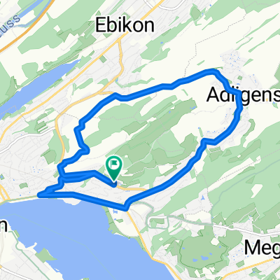
Erich‘s Surprise-Tour 2.0 (Richtung Sins)
- 99.4 km
- 1,028 m
- 1,010 m
- Adligenswil, Canton of Lucerne, Switzerland
A cycling route starting in Adligenswil, Canton of Lucerne, Switzerland.
Overview
created this 5 years ago


Route quality
Cycleway
7.1 km
(11 %)
Path
2.6 km
(4 %)
Paved
33.3 km
(52 %)
Unpaved
1.3 km
(2 %)
Asphalt
32.7 km
(51 %)
Unpaved (undefined)
1.3 km
(2 %)
Continue with Bikemap
You would like to ride Zogersee via Cham mit Andi u. Mägi or customize it for your own trip? Here is what you can do with this Bikemap route:
Free trial for 3 days, or one-time payment. More about Bikemap Premium.
Discover more Premium features.
Get Bikemap PremiumFrom our community
Open it in the app