

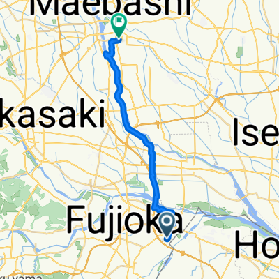
赤城山ー金精峠
A cycling route starting in Fujioka, Gunma, Japan.
Overview
About this route
- -:--
- Duration
- 141.5 km
- Distance
- 2,742 m
- Ascent
- 2,266 m
- Descent
- ---
- Avg. speed
- ---
- Max. altitude
Continue with Bikemap
Use, edit, or download this cycling route
You would like to ride 赤城山ー金精峠 or customize it for your own trip? Here is what you can do with this Bikemap route:
Free features
- Save this route as favorite or in collections
- Copy & plan your own version of this route
- Split it into stages to create a multi-day tour
- Sync your route with Garmin or Wahoo
Premium features
Free trial for 3 days, or one-time payment. More about Bikemap Premium.
- Navigate this route on iOS & Android
- Export a GPX / KML file of this route
- Create your custom printout (try it for free)
- Download this route for offline navigation
Discover more Premium features.
Get Bikemap PremiumFrom our community
Other popular routes starting in Fujioka
 新町, 高崎市へ表町1丁目, 前橋市
- Distance
- 18 km
- Ascent
- 69 m
- Descent
- 32 m
- Location
- Fujioka, Gunma, Japan
 89 神川健康緑道周遊ルート
- Distance
- 12.2 km
- Ascent
- 94 m
- Descent
- 95 m
- Location
- Fujioka, Gunma, Japan
 The Tomioka Silk Mill and Mt.Myougi
- Distance
- 55.4 km
- Ascent
- 686 m
- Descent
- 489 m
- Location
- Fujioka, Gunma, Japan
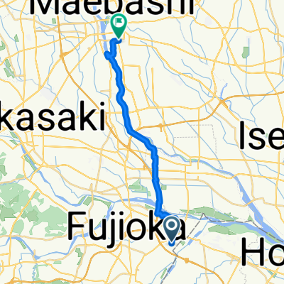
 赤城山ー金精峠
- Distance
- 141.5 km
- Ascent
- 2,742 m
- Descent
- 2,266 m
- Location
- Fujioka, Gunma, Japan
 新町, 高崎市へ表町1丁目, 前橋市
- Distance
- 17.9 km
- Ascent
- 69 m
- Descent
- 32 m
- Location
- Fujioka, Gunma, Japan
 Fujioka short climb
- Distance
- 12.2 km
- Ascent
- 599 m
- Descent
- 241 m
- Location
- Fujioka, Gunma, Japan
 新町, 高崎市へ表町1丁目, 前橋市
- Distance
- 25 km
- Ascent
- 84 m
- Descent
- 49 m
- Location
- Fujioka, Gunma, Japan
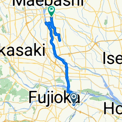
 16−4, 藤岡市 to 雁坂みち, 秩父市
- Distance
- 72.6 km
- Ascent
- 4,923 m
- Descent
- 3,872 m
- Location
- Fujioka, Gunma, Japan
Open it in the app