Villarrica - Puc贸n #6 (7 Lagos Chile)
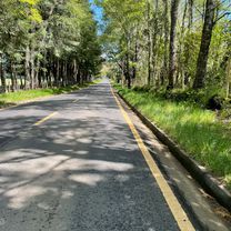
A cycling route starting in Villarrica, Regi贸n de la Araucan铆a, Chile.
Overview
About this route
- -:--
- Duration
- 37.6 km
- Distance
- 550 m
- Ascent
- 548 m
- Descent
- ---
- Avg. speed
- ---
- Avg. speed
Route quality
Waytypes & surfaces along the route
Waytypes
Busy road
22 km
(59 %)
Quiet road
8.3 km
(22 %)
Surfaces
Paved
30.1 km
(80 %)
Unpaved
7.3 km
(19 %)
Asphalt
21.5 km
(57 %)
Paved (undefined)
7.3 km
(19 %)
Route highlights
Points of interest along the route
Point of interest after 30.2 km
Cascada el claro, lugar recomendado para visitar, el camino es bastante complejo porque tiene muchas subido y el camino es de tierra, se debe ir pedaleando ligero.
Continue with Bikemap
Use, edit, or download this cycling route
You would like to ride Villarrica - Puc贸n #6 (7 Lagos Chile) or customize it for your own trip? Here is what you can do with this Bikemap route:
Free features
- Save this route as favorite or in collections
- Copy & plan your own version of this route
- Sync your route with Garmin or Wahoo
Premium features
Free trial for 3 days, or one-time payment. More about Bikemap Premium.
- Navigate this route on iOS & Android
- Export a GPX / KML file of this route
- Create your custom printout (try it for free)
- Download this route for offline navigation
Discover more Premium features.
Get Bikemap PremiumFrom our community
Other popular routes starting in Villarrica
- Villarrica - Puc贸n #6 (7 Lagos Chile)
- Distance
- 37.6 km
- Ascent
- 550 m
- Descent
- 548 m
- Location
- Villarrica, Regi贸n de la Araucan铆a, Chile
- Ciclotur verano 2011
- Distance
- 649.6 km
- Ascent
- 3,173 m
- Descent
- 3,373 m
- Location
- Villarrica, Regi贸n de la Araucan铆a, Chile
- De Las Camelias 1295, Villarrica a Pasaje Los Lirios 1246, Villarrica
- Distance
- 20.4 km
- Ascent
- 383 m
- Descent
- 384 m
- Location
- Villarrica, Regi贸n de la Araucan铆a, Chile
- Lake District 8. Etappe Villarrica - Co帽aripe
- Distance
- 52.5 km
- Ascent
- 496 m
- Descent
- 501 m
- Location
- Villarrica, Regi贸n de la Araucan铆a, Chile
- Villarica - Puc贸n
- Distance
- 23.3 km
- Ascent
- 216 m
- Descent
- 210 m
- Location
- Villarrica, Regi贸n de la Araucan铆a, Chile
- Villarrica - Junin de los Andes
- Distance
- 169.7 km
- Ascent
- 1,649 m
- Descent
- 1,158 m
- Location
- Villarrica, Regi贸n de la Araucan铆a, Chile
- Conquil-Lefun
- Distance
- 21.7 km
- Ascent
- 185 m
- Descent
- 185 m
- Location
- Villarrica, Regi贸n de la Araucan铆a, Chile
- Cervecer铆a Cr谩ter
- Distance
- 20 km
- Ascent
- 219 m
- Descent
- 221 m
- Location
- Villarrica, Regi贸n de la Araucan铆a, Chile