

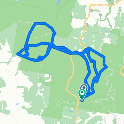
Brookfield - 3 Fingers
A cycling route starting in Kenmore Hills, Queensland, Australia.
Overview
About this route
- -:--
- Duration
- 39.8 km
- Distance
- 768 m
- Ascent
- 760 m
- Descent
- ---
- Avg. speed
- ---
- Max. altitude

Route quality
Waytypes & surfaces along the route
Waytypes
Road
19.1 km
(48 %)
Quiet road
17.9 km
(45 %)
Surfaces
Paved
37.8 km
(95 %)
Asphalt
19.1 km
(48 %)
Paved (undefined)
18.7 km
(47 %)
Undefined
2 km
(5 %)
Continue with Bikemap
Use, edit, or download this cycling route
You would like to ride Brookfield - 3 Fingers or customize it for your own trip? Here is what you can do with this Bikemap route:
Free features
- Save this route as favorite or in collections
- Copy & plan your own version of this route
- Sync your route with Garmin or Wahoo
Premium features
Free trial for 3 days, or one-time payment. More about Bikemap Premium.
- Navigate this route on iOS & Android
- Export a GPX / KML file of this route
- Create your custom printout (try it for free)
- Download this route for offline navigation
Discover more Premium features.
Get Bikemap PremiumFrom our community
Other popular routes starting in Kenmore Hills
 Route from Quail Trail, Mount Coot-Tha
- Distance
- 19.3 km
- Ascent
- 681 m
- Descent
- 680 m
- Location
- Kenmore Hills, Queensland, Australia
 18 Farnworth Street, Chapel Hill to 18 Farnworth Street, Chapel Hill
- Distance
- 15.9 km
- Ascent
- 330 m
- Descent
- 330 m
- Location
- Kenmore Hills, Queensland, Australia
 2–12 Spearwood Place, Kenmore Hills to 95-111 Ward Street, Indooroopilly
- Distance
- 6.4 km
- Ascent
- 90 m
- Descent
- 113 m
- Location
- Kenmore Hills, Queensland, Australia
 Seventeen Mile Rocks Loop
- Distance
- 18.6 km
- Ascent
- 207 m
- Descent
- 184 m
- Location
- Kenmore Hills, Queensland, Australia
 New commute from Chapel Hill
- Distance
- 13.8 km
- Ascent
- 184 m
- Descent
- 245 m
- Location
- Kenmore Hills, Queensland, Australia
 From Brookfield to Saint Lucia
- Distance
- 14 km
- Ascent
- 135 m
- Descent
- 147 m
- Location
- Kenmore Hills, Queensland, Australia
 Indooroopilly-Moggill ferry loop
- Distance
- 39.4 km
- Ascent
- 294 m
- Descent
- 294 m
- Location
- Kenmore Hills, Queensland, Australia
 Loop: Moggil, Ipswich, Jindalee
- Distance
- 39.9 km
- Ascent
- 376 m
- Descent
- 377 m
- Location
- Kenmore Hills, Queensland, Australia
Open it in the app