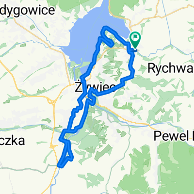
Pętla Gilowicka
A cycling route starting in Łękawica, Silesian Voivodeship, Poland.
Overview
About this route
Trasa nadająca się znakomicie na pętlę do poważnego ścigania.
- -:--
- Duration
- 25 km
- Distance
- 442 m
- Ascent
- 442 m
- Descent
- ---
- Avg. speed
- ---
- Avg. speed
Route quality
Waytypes & surfaces along the route
Waytypes
Road
15.4 km
(62 %)
Quiet road
4.7 km
(19 %)
Surfaces
Paved
20.8 km
(83 %)
Asphalt
20.8 km
(83 %)
Undefined
4.2 km
(17 %)
Continue with Bikemap
Use, edit, or download this cycling route
You would like to ride Pętla Gilowicka or customize it for your own trip? Here is what you can do with this Bikemap route:
Free features
- Save this route as favorite or in collections
- Copy & plan your own version of this route
- Sync your route with Garmin or Wahoo
Premium features
Free trial for 3 days, or one-time payment. More about Bikemap Premium.
- Navigate this route on iOS & Android
- Export a GPX / KML file of this route
- Create your custom printout (try it for free)
- Download this route for offline navigation
Discover more Premium features.
Get Bikemap PremiumFrom our community
Other popular routes starting in Łękawica
- Beskid Śląski i Żywiecki
- Distance
- 108.4 km
- Ascent
- 1,384 m
- Descent
- 1,383 m
- Location
- Łękawica, Silesian Voivodeship, Poland
- Groniowa 2, Łękawica do Szczytowa 29, Łękawica
- Distance
- 4.8 km
- Ascent
- 263 m
- Descent
- 212 m
- Location
- Łękawica, Silesian Voivodeship, Poland
- 2018-05-25 on GPSies.com
- Distance
- 76.1 km
- Ascent
- 2,747 m
- Descent
- 2,749 m
- Location
- Łękawica, Silesian Voivodeship, Poland
- Żywiecka 21, Łękawica do Beskidzka 85–95, Łękawica
- Distance
- 4.8 km
- Ascent
- 917 m
- Descent
- 872 m
- Location
- Łękawica, Silesian Voivodeship, Poland
- Parkowa 21, Kocierz Moszczanicki do Szczytowa 29, Łękawica
- Distance
- 6.6 km
- Ascent
- 4,927 m
- Descent
- 4,608 m
- Location
- Łękawica, Silesian Voivodeship, Poland
- 49.754° N 19.271° W do 49.758° N 19.288° W
- Distance
- 1.5 km
- Ascent
- 22 m
- Descent
- 0 m
- Location
- Łękawica, Silesian Voivodeship, Poland
- Pętla Gilowicka
- Distance
- 25 km
- Ascent
- 442 m
- Descent
- 442 m
- Location
- Łękawica, Silesian Voivodeship, Poland
- Okrężna do ślemienia i Rychwałdu
- Distance
- 46.5 km
- Ascent
- 526 m
- Descent
- 531 m
- Location
- Łękawica, Silesian Voivodeship, Poland
Open it in the app