

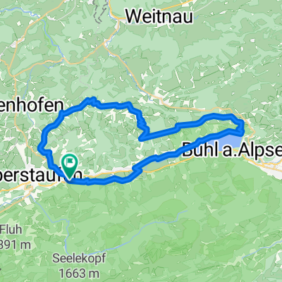
Oberstaufen-Rohrmoss-Oberstaufen
A cycling route starting in Oberstaufen, Bavaria, Germany.
Overview
About this route
Von Oberstaufen auf der Nebenstecke leicht wellig am Alpsee entlang nach Immenstadt, dann weiter über Blaichach bis kurz vor Sonthofen, dort rechts abbiegen nach Ofterschwang (14 % Steigung), wieder bergab nach Obermaiselstein, weiter nach Tiefenbach. Dort rechts nach Rohrmoos abbiegen, wieder längere Steigung. Nach Mautstation (für Radler kostenfrei) auf kleiner Straße erst weiter bergan, dann schöne Abfahrt zum Hirschgrund und weiter bergan nach Sibratsgfäll (Österreich) Dort im "Adler" leckeren Kaiserschmarrn essen, denn danach geht´s erst einmal wieder bergan, dann aber bergab bis Hittisau. Von dort wellig zurück bis nach Weißbach, dann der Schlußanstieg ( 150 Höhenmeter) bis zum Ortskern in Oberstaufen. Siegerehrung mit Hefeweizen an der Kirche ist Pflicht.
- -:--
- Duration
- 82.4 km
- Distance
- 823 m
- Ascent
- 823 m
- Descent
- ---
- Avg. speed
- ---
- Max. altitude
Route quality
Waytypes & surfaces along the route
Waytypes
Quiet road
33.4 km
(41 %)
Busy road
19 km
(23 %)
Surfaces
Paved
75.9 km
(92 %)
Unpaved
1.7 km
(2 %)
Asphalt
75.8 km
(92 %)
Loose gravel
0.9 km
(1 %)
Continue with Bikemap
Use, edit, or download this cycling route
You would like to ride Oberstaufen-Rohrmoss-Oberstaufen or customize it for your own trip? Here is what you can do with this Bikemap route:
Free features
- Save this route as favorite or in collections
- Copy & plan your own version of this route
- Split it into stages to create a multi-day tour
- Sync your route with Garmin or Wahoo
Premium features
Free trial for 3 days, or one-time payment. More about Bikemap Premium.
- Navigate this route on iOS & Android
- Export a GPX / KML file of this route
- Create your custom printout (try it for free)
- Download this route for offline navigation
Discover more Premium features.
Get Bikemap PremiumFrom our community
Other popular routes starting in Oberstaufen
 Oberstaufen-Rohrmoss-Oberstaufen
- Distance
- 82.4 km
- Ascent
- 834 m
- Descent
- 834 m
- Location
- Oberstaufen, Bavaria, Germany
 Alpsee-Panorama
- Distance
- 35.1 km
- Ascent
- 597 m
- Descent
- 597 m
- Location
- Oberstaufen, Bavaria, Germany
 Am Kalvarienberg nach Am Kalvarienberg
- Distance
- 53.8 km
- Ascent
- 548 m
- Descent
- 561 m
- Location
- Oberstaufen, Bavaria, Germany
 Um den Hündle
- Distance
- 13.7 km
- Ascent
- 584 m
- Descent
- 584 m
- Location
- Oberstaufen, Bavaria, Germany
 Oberstaufen -Gardasee 2013
- Distance
- 397.7 km
- Ascent
- 4,038 m
- Descent
- 4,762 m
- Location
- Oberstaufen, Bavaria, Germany
 Kleine Grenzrunde
- Distance
- 35.5 km
- Ascent
- 516 m
- Descent
- 516 m
- Location
- Oberstaufen, Bavaria, Germany
 Übers Hündle
- Distance
- 10.8 km
- Ascent
- 408 m
- Descent
- 411 m
- Location
- Oberstaufen, Bavaria, Germany
 Oberstaufen
- Distance
- 43.1 km
- Ascent
- 837 m
- Descent
- 837 m
- Location
- Oberstaufen, Bavaria, Germany
Open it in the app