
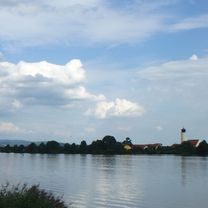
Danube River part 1 (Donaueschingen to Rennertshofen) - Germany
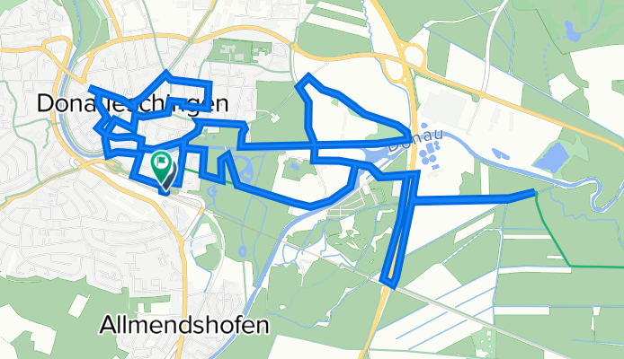
D0 Donaueschingen circuit (Germany)
A cycling route starting in Donaueschingen, Baden-Wurttemberg, Germany.
Overview
About this route
Exploring the area and understanding the source of the Donau (Danube) River, in order to head off the next day,.
- -:--
- Duration
- 14.3 km
- Distance
- 64 m
- Ascent
- 65 m
- Descent
- ---
- Avg. speed
- 702 m
- Max. altitude

Part of
Route quality
Waytypes & surfaces along the route
Waytypes
Quiet road
5.6 km
(39 %)
Track
5 km
(35 %)
Surfaces
Paved
9.8 km
(69 %)
Unpaved
1.9 km
(13 %)
Asphalt
9.7 km
(68 %)
Gravel
0.7 km
(5 %)
Continue with Bikemap
Use, edit, or download this cycling route
You would like to ride D0 Donaueschingen circuit (Germany) or customize it for your own trip? Here is what you can do with this Bikemap route:
Free features
- Save this route as favorite or in collections
- Copy & plan your own version of this route
- Sync your route with Garmin or Wahoo
Premium features
Free trial for 3 days, or one-time payment. More about Bikemap Premium.
- Navigate this route on iOS & Android
- Export a GPX / KML file of this route
- Create your custom printout (try it for free)
- Download this route for offline navigation
Discover more Premium features.
Get Bikemap PremiumFrom our community
Other popular routes starting in Donaueschingen
 Donaueschingen - Fürstenberg - Geisingen - Donaueschingen
- Distance
- 50.2 km
- Ascent
- 249 m
- Descent
- 249 m
- Location
- Donaueschingen, Baden-Wurttemberg, Germany
 Donauradweg (1)
- Distance
- 295 km
- Ascent
- 163 m
- Descent
- 434 m
- Location
- Donaueschingen, Baden-Wurttemberg, Germany
 An der Donau entlang
- Distance
- 165.5 km
- Ascent
- 403 m
- Descent
- 591 m
- Location
- Donaueschingen, Baden-Wurttemberg, Germany
 Donauradweg
- Distance
- 984.1 km
- Ascent
- 267 m
- Descent
- 552 m
- Location
- Donaueschingen, Baden-Wurttemberg, Germany
 Donauradweg
- Distance
- 86.1 km
- Ascent
- 246 m
- Descent
- 370 m
- Location
- Donaueschingen, Baden-Wurttemberg, Germany
 Donautour 1.Etappe
- Distance
- 99.3 km
- Ascent
- 311 m
- Descent
- 407 m
- Location
- Donaueschingen, Baden-Wurttemberg, Germany
 31km-DonauEntspring Donaueschingen
- Distance
- 31.3 km
- Ascent
- 180 m
- Descent
- 181 m
- Location
- Donaueschingen, Baden-Wurttemberg, Germany
 Der Donauradweg
- Distance
- 622.8 km
- Ascent
- 3,031 m
- Descent
- 3,406 m
- Location
- Donaueschingen, Baden-Wurttemberg, Germany
Open it in the app