
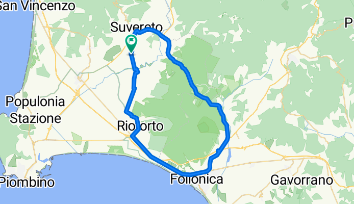
Da Località San Michele 49, Suvereto a Località San Michele 49, Suvereto
A cycling route starting in Suvereto, Tuscany, Italy.
Overview
About this route
- 2 h 21 min
- Duration
- 47.7 km
- Distance
- 255 m
- Ascent
- 268 m
- Descent
- 20.2 km/h
- Avg. speed
- ---
- Max. altitude

Route quality
Waytypes & surfaces along the route
Waytypes
Road
6.7 km
(14 %)
Quiet road
4.3 km
(9 %)
Surfaces
Paved
28.6 km
(60 %)
Unpaved
3.3 km
(7 %)
Asphalt
28.6 km
(60 %)
Gravel
1.9 km
(4 %)
Continue with Bikemap
Use, edit, or download this cycling route
You would like to ride Da Località San Michele 49, Suvereto a Località San Michele 49, Suvereto or customize it for your own trip? Here is what you can do with this Bikemap route:
Free features
- Save this route as favorite or in collections
- Copy & plan your own version of this route
- Sync your route with Garmin or Wahoo
Premium features
Free trial for 3 days, or one-time payment. More about Bikemap Premium.
- Navigate this route on iOS & Android
- Export a GPX / KML file of this route
- Create your custom printout (try it for free)
- Download this route for offline navigation
Discover more Premium features.
Get Bikemap PremiumFrom our community
Other popular routes starting in Suvereto
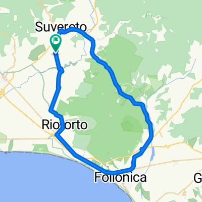 Da Località San Michele 49, Suvereto a Località San Michele 49, Suvereto
- Distance
- 47.7 km
- Ascent
- 255 m
- Descent
- 268 m
- Location
- Suvereto, Tuscany, Italy
 Tour Agliail
- Distance
- 32.8 km
- Ascent
- 413 m
- Descent
- 410 m
- Location
- Suvereto, Tuscany, Italy
 Costa Etruschi - Giorno3.2
- Distance
- 29.5 km
- Ascent
- 304 m
- Descent
- 372 m
- Location
- Suvereto, Tuscany, Italy
 a max - zu den schwefeldämpfen von larderello
- Distance
- 131.3 km
- Ascent
- 2,959 m
- Descent
- 2,956 m
- Location
- Suvereto, Tuscany, Italy
 suv mont
- Distance
- 44.4 km
- Ascent
- 464 m
- Descent
- 470 m
- Location
- Suvereto, Tuscany, Italy
 da max - massa marittima
- Distance
- 72.7 km
- Ascent
- 1,138 m
- Descent
- 1,356 m
- Location
- Suvereto, Tuscany, Italy
 Sassetta-Monteverdi-Bolgheri 90Km / 1000Hm
- Distance
- 90.3 km
- Ascent
- 832 m
- Descent
- 841 m
- Location
- Suvereto, Tuscany, Italy
 Suvereto_Casa_Ray
- Distance
- 5 km
- Ascent
- 187 m
- Descent
- 83 m
- Location
- Suvereto, Tuscany, Italy
Open it in the app