

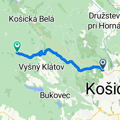
Vyšna Myšľa-Izra
A cycling route starting in Košice, Košice Region, Slovakia.
Overview
About this route
The route runs about 80% on a forest asphalt road, only behind Myšľa is there currently a gravel road (in a year there should also be a new bike path paved here). When you encounter the asphalt in the forest, turn left. After the barrier, about 100 m later, turn right into the steep hill (few manage to climb it, but there are also some heroes) and this shortcut will lead you to the junction above Slanec. Here you have another 12 km to the goal. At the first intersection in the shape of a Y (after about 300 m) turn left and after that, you can't go wrong. From Izra you can continue further into Hungary and return to Slovakia, for example through Skaroš.
- -:--
- Duration
- 19 km
- Distance
- 519 m
- Ascent
- 323 m
- Descent
- ---
- Avg. speed
- ---
- Max. altitude

Route quality
Waytypes & surfaces along the route
Waytypes
Track
18.4 km
(97 %)
Quiet road
0.4 km
(2 %)
Undefined
0.2 km
(1 %)
Surfaces
Paved
12.4 km
(65 %)
Unpaved
6.1 km
(32 %)
Asphalt
9.5 km
(50 %)
Gravel
5.1 km
(27 %)
Route highlights
Points of interest along the route

Point of interest after 8.8 km

Point of interest after 18.7 km

Point of interest after 19 km
Continue with Bikemap
Use, edit, or download this cycling route
You would like to ride Vyšna Myšľa-Izra or customize it for your own trip? Here is what you can do with this Bikemap route:
Free features
- Save this route as favorite or in collections
- Copy & plan your own version of this route
- Sync your route with Garmin or Wahoo
Premium features
Free trial for 3 days, or one-time payment. More about Bikemap Premium.
- Navigate this route on iOS & Android
- Export a GPX / KML file of this route
- Create your custom printout (try it for free)
- Download this route for offline navigation
Discover more Premium features.
Get Bikemap PremiumFrom our community
Other popular routes starting in Košice
 KE(Furca) - Hrasovik - Beniakovce - Vajkovce - KE(Krematorium) - KE(Furca)
- Distance
- 14.1 km
- Ascent
- 195 m
- Descent
- 190 m
- Location
- Košice, Košice Region, Slovakia
 Lajoška 26.6.2010
- Distance
- 43 km
- Ascent
- 851 m
- Descent
- 853 m
- Location
- Košice, Košice Region, Slovakia
 Tahanovce most-Anicka-Cermel-Alpinka-chata Hresna-Anicka-Tahanovce most
- Distance
- 22.5 km
- Ascent
- 406 m
- Descent
- 406 m
- Location
- Košice, Košice Region, Slovakia
 Jahodna -- Bankov -- ke-kvp-MOST pri Jazdiarni
- Distance
- 10 km
- Ascent
- 103 m
- Descent
- 392 m
- Location
- Košice, Košice Region, Slovakia
 Po stopách košických sôch I.
- Distance
- 2.2 km
- Ascent
- 8 m
- Descent
- 0 m
- Location
- Košice, Košice Region, Slovakia
 2020_Cermel_Lajoska_I
- Distance
- 15.5 km
- Ascent
- 822 m
- Descent
- 143 m
- Location
- Košice, Košice Region, Slovakia
 Silvestrovská cyklojazda s MedBike_m4y0
- Distance
- 19.9 km
- Ascent
- 235 m
- Descent
- 235 m
- Location
- Košice, Košice Region, Slovakia
 Proenzi Cyklotour Slovakia 2014
- Distance
- 559.3 km
- Ascent
- 1,620 m
- Descent
- 1,575 m
- Location
- Košice, Košice Region, Slovakia
Open it in the app