

Stage 7 - Cent Cols
A cycling route starting in Gourdan-Polignan, Occitanie, France.
Overview
About this route
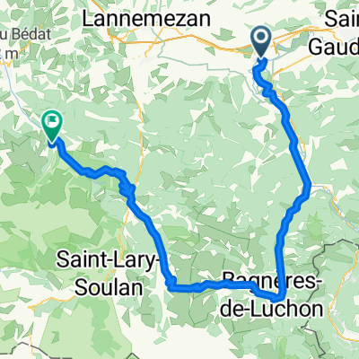
Luscan to St Christau
- -:--
- Duration
- 181.7 km
- Distance
- 2,440 m
- Ascent
- 2,574 m
- Descent
- ---
- Avg. speed
- ---
- Max. altitude

Route quality
Waytypes & surfaces along the route
Waytypes
Road
79.6 km
(44 %)
Busy road
48.9 km
(27 %)
Surfaces
Paved
53 km
(29 %)
Unpaved
10.8 km
(6 %)
Asphalt
53 km
(29 %)
Ground
7 km
(4 %)
Route highlights
Points of interest along the route
Point of interest after 26.3 km
Col de Mazouau
Point of interest after 31.5 km
Col de Luquet
Point of interest after 34 km
Col de Coupe
Point of interest after 45.1 km
Couret d'Asque
Point of interest after 57.2 km
Col des Palomieres
Point of interest after 70.7 km
Col de Saoucede
Point of interest after 89.1 km
Col de Lingous
Point of interest after 121.9 km
Col de Spandelles
Point of interest after 142.5 km
Col de Tisnes
Point of interest after 143.4 km
Col de Hosse
Point of interest after 153.5 km
Col des Bouts
Continue with Bikemap
Use, edit, or download this cycling route
You would like to ride Stage 7 - Cent Cols or customize it for your own trip? Here is what you can do with this Bikemap route:
Free features
- Save this route as favorite or in collections
- Copy & plan your own version of this route
- Split it into stages to create a multi-day tour
- Sync your route with Garmin or Wahoo
Premium features
Free trial for 3 days, or one-time payment. More about Bikemap Premium.
- Navigate this route on iOS & Android
- Export a GPX / KML file of this route
- Create your custom printout (try it for free)
- Download this route for offline navigation
Discover more Premium features.
Get Bikemap PremiumFrom our community
Other popular routes starting in Gourdan-Polignan
 Mauleon-Barousse - Arreau
- Distance
- 83.2 km
- Ascent
- 2,574 m
- Descent
- 2,435 m
- Location
- Gourdan-Polignan, Occitanie, France
 Col des Ares Loop from Fronsac
- Distance
- 49.9 km
- Ascent
- 673 m
- Descent
- 666 m
- Location
- Gourdan-Polignan, Occitanie, France
 1988 Motorrad Spanien
- Distance
- 5,326.8 km
- Ascent
- 9,049 m
- Descent
- 9,476 m
- Location
- Gourdan-Polignan, Occitanie, France
 Bertren, Port de Bales, Col de Peyresourde loop
- Distance
- 117.5 km
- Ascent
- 2,173 m
- Descent
- 2,173 m
- Location
- Gourdan-Polignan, Occitanie, France
 Loures-Barousse - Port de Boucharo
- Distance
- 182.1 km
- Ascent
- 5,830 m
- Descent
- 4,004 m
- Location
- Gourdan-Polignan, Occitanie, France
 FR Montréjeau - Über Peyresourde und Aspin nach Campan
- Distance
- 99.1 km
- Ascent
- 2,110 m
- Descent
- 1,636 m
- Location
- Gourdan-Polignan, Occitanie, France
 Saint Bertrand-Comminges-Sarrancolin-Arreau-Bordères Louron-Col de Peyresurde-Saint-Aventin-Port de Balès-Mauleon Barousse-Saint Bertrand-Comminges
- Distance
- 110.8 km
- Ascent
- 2,115 m
- Descent
- 2,115 m
- Location
- Gourdan-Polignan, Occitanie, France
 2 Saint Bertrand Comminges - Lourdes
- Distance
- 63.6 km
- Ascent
- 785 m
- Descent
- 838 m
- Location
- Gourdan-Polignan, Occitanie, France
Open it in the app