

dreitalsperrentour CLONED FROM ROUTE 414516
A cycling route starting in Unterschönau, Thuringia, Germany.
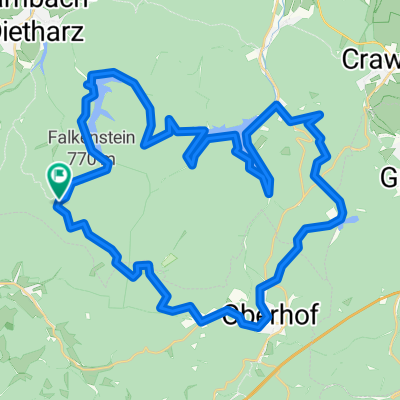
Overview
About this route
- -:--
- Duration
- 45 km
- Distance
- 815 m
- Ascent
- 815 m
- Descent
- ---
- Avg. speed
- ---
- Max. altitude
Route quality
Waytypes & surfaces along the route
Waytypes
Track
37.8 km
(84 %)
Quiet road
1.3 km
(3 %)
Surfaces
Paved
18.4 km
(41 %)
Unpaved
23.4 km
(52 %)
Asphalt
18.4 km
(41 %)
Gravel
17.1 km
(38 %)
Continue with Bikemap
Use, edit, or download this cycling route
You would like to ride dreitalsperrentour CLONED FROM ROUTE 414516 or customize it for your own trip? Here is what you can do with this Bikemap route:
Free features
- Save this route as favorite or in collections
- Copy & plan your own version of this route
- Sync your route with Garmin or Wahoo
Premium features
Free trial for 3 days, or one-time payment. More about Bikemap Premium.
- Navigate this route on iOS & Android
- Export a GPX / KML file of this route
- Create your custom printout (try it for free)
- Download this route for offline navigation
Discover more Premium features.
Get Bikemap PremiumFrom our community
Other popular routes starting in Unterschönau
 Feierabendrunde
- Distance
- 15.5 km
- Ascent
- 361 m
- Descent
- 364 m
- Location
- Unterschönau, Thuringia, Germany
 dreitalsperrentour
- Distance
- 44.9 km
- Ascent
- 1,033 m
- Descent
- 987 m
- Location
- Unterschönau, Thuringia, Germany
 dreitalsperrentour CLONED FROM ROUTE 414516
- Distance
- 45 km
- Ascent
- 815 m
- Descent
- 815 m
- Location
- Unterschönau, Thuringia, Germany
 Unterschönau Großer Hermannsberg
- Distance
- 18.7 km
- Ascent
- 480 m
- Descent
- 482 m
- Location
- Unterschönau, Thuringia, Germany
 Oberschönau-Ski und Wanderhütte rund um den Hermannsberg.gpx
- Distance
- 4.1 km
- Ascent
- 201 m
- Descent
- 205 m
- Location
- Unterschönau, Thuringia, Germany
 Urlaub
- Distance
- 3.7 km
- Ascent
- 222 m
- Descent
- 233 m
- Location
- Unterschönau, Thuringia, Germany
 Dreitalsperrentour V 2.0 vom 04.06.2011
- Distance
- 40.3 km
- Ascent
- 746 m
- Descent
- 746 m
- Location
- Unterschönau, Thuringia, Germany
 Steinbacher Straße, Tambach-Dietharz nach Lindenberg 8, Weimar
- Distance
- 367.8 km
- Ascent
- 1,612 m
- Descent
- 2,114 m
- Location
- Unterschönau, Thuringia, Germany
Open it in the app