
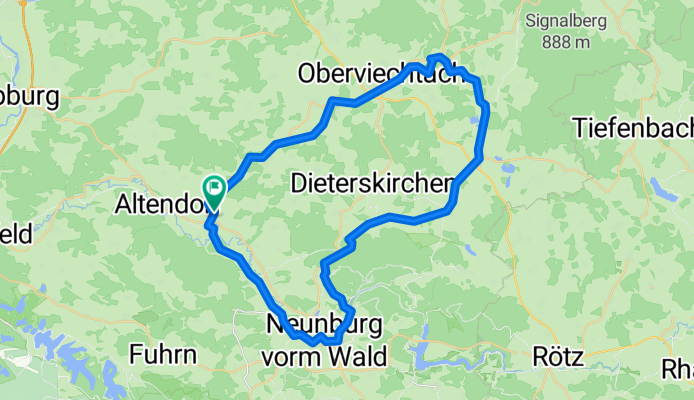
Moosrunde
A cycling route starting in Altendorf, Bavaria, Germany.
Overview
About this route
These GPS data are the property of the geo-coaching project and are intended exclusively for personal use. Commercial use is not permitted without authorization.
- 3 h 12 min
- Duration
- 46.8 km
- Distance
- 434 m
- Ascent
- 434 m
- Descent
- 14.6 km/h
- Avg. speed
- ---
- Max. altitude
Route quality
Waytypes & surfaces along the route
Waytypes
Cycleway
15.9 km
(34 %)
Road
8.9 km
(19 %)
Surfaces
Paved
7 km
(15 %)
Unpaved
23.4 km
(50 %)
Unpaved (undefined)
10.8 km
(23 %)
Loose gravel
8.9 km
(19 %)
Continue with Bikemap
Use, edit, or download this cycling route
You would like to ride Moosrunde or customize it for your own trip? Here is what you can do with this Bikemap route:
Free features
- Save this route as favorite or in collections
- Copy & plan your own version of this route
- Sync your route with Garmin or Wahoo
Premium features
Free trial for 3 days, or one-time payment. More about Bikemap Premium.
- Navigate this route on iOS & Android
- Export a GPX / KML file of this route
- Create your custom printout (try it for free)
- Download this route for offline navigation
Discover more Premium features.
Get Bikemap PremiumFrom our community
Other popular routes starting in Altendorf
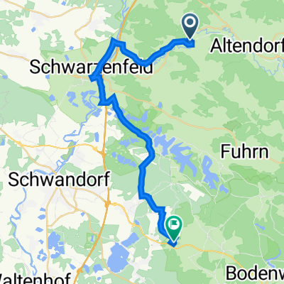 Müllnerhof Rückweg
- Distance
- 25.6 km
- Ascent
- 200 m
- Descent
- 154 m
- Location
- Altendorf, Bavaria, Germany
 Uckersdorf 17, Schwarzhofen nach Uckersdorf 14, Schwarzhofen
- Distance
- 50.4 km
- Ascent
- 844 m
- Descent
- 844 m
- Location
- Altendorf, Bavaria, Germany
 Unterauerbach-Altfalter-Altendorf
- Distance
- 15.3 km
- Ascent
- 313 m
- Descent
- 313 m
- Location
- Altendorf, Bavaria, Germany
 Rückweg
- Distance
- 25.3 km
- Ascent
- 457 m
- Descent
- 425 m
- Location
- Altendorf, Bavaria, Germany
 Moosrunde
- Distance
- 46.8 km
- Ascent
- 434 m
- Descent
- 434 m
- Location
- Altendorf, Bavaria, Germany
 Schwarzach zum Darlesberg, über Diendorf zum Kocherstollen
- Distance
- 15.4 km
- Ascent
- 470 m
- Descent
- 518 m
- Location
- Altendorf, Bavaria, Germany
 Eixendorfer Stausee von Schwarzach über Neunburg
- Distance
- 57.1 km
- Ascent
- 1,063 m
- Descent
- 1,074 m
- Location
- Altendorf, Bavaria, Germany
 Altendorf-Wagnern-Murachtal
- Distance
- 21.8 km
- Ascent
- 300 m
- Descent
- 291 m
- Location
- Altendorf, Bavaria, Germany
Open it in the app