

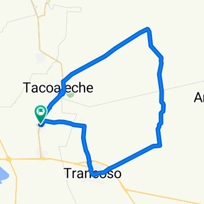
Zóquite-Tolosa
A cycling route starting in Tacoaleche, Zacatecas, Mexico.
Overview
About this route
- 3 h 31 min
- Duration
- 33.3 km
- Distance
- 314 m
- Ascent
- 322 m
- Descent
- 9.5 km/h
- Avg. speed
- ---
- Max. altitude

Route photos

Continue with Bikemap
Use, edit, or download this cycling route
You would like to ride Zóquite-Tolosa or customize it for your own trip? Here is what you can do with this Bikemap route:
Free features
- Save this route as favorite or in collections
- Copy & plan your own version of this route
- Sync your route with Garmin or Wahoo
Premium features
Free trial for 3 days, or one-time payment. More about Bikemap Premium.
- Navigate this route on iOS & Android
- Export a GPX / KML file of this route
- Create your custom printout (try it for free)
- Download this route for offline navigation
Discover more Premium features.
Get Bikemap PremiumFrom our community
Other popular routes starting in Tacoaleche
 Zóquite-Santa Mónica- Tacoaleche
- Distance
- 18.6 km
- Ascent
- 165 m
- Descent
- 165 m
- Location
- Tacoaleche, Zacatecas, Mexico
 De Ricardo Flores Magón 5, Zoquite a Ricardo Flores Magón 5, Zoquite
- Distance
- 12.1 km
- Ascent
- 94 m
- Descent
- 93 m
- Location
- Tacoaleche, Zacatecas, Mexico
 Zóquite-Tolosa
- Distance
- 33.3 km
- Ascent
- 314 m
- Descent
- 322 m
- Location
- Tacoaleche, Zacatecas, Mexico
 Zóquite-Tolosa-Guadalupe
- Distance
- 47.5 km
- Ascent
- 476 m
- Descent
- 425 m
- Location
- Tacoaleche, Zacatecas, Mexico
 De Ricardo Flores Magón 5, Zoquite a Ricardo Flores Magón 5, Zoquite
- Distance
- 49.8 km
- Ascent
- 248 m
- Descent
- 247 m
- Location
- Tacoaleche, Zacatecas, Mexico
 Paseo rápido en Zoquite
- Distance
- 9.4 km
- Ascent
- 55 m
- Descent
- 58 m
- Location
- Tacoaleche, Zacatecas, Mexico
 Ruta rápida en Guadalupe
- Distance
- 6.6 km
- Ascent
- 12 m
- Descent
- 12 m
- Location
- Tacoaleche, Zacatecas, Mexico
 Zóquite Trancoso
- Distance
- 53 km
- Ascent
- 259 m
- Descent
- 256 m
- Location
- Tacoaleche, Zacatecas, Mexico
Open it in the app