

Danube River part 3 (Kelheim to Passau) - Germany
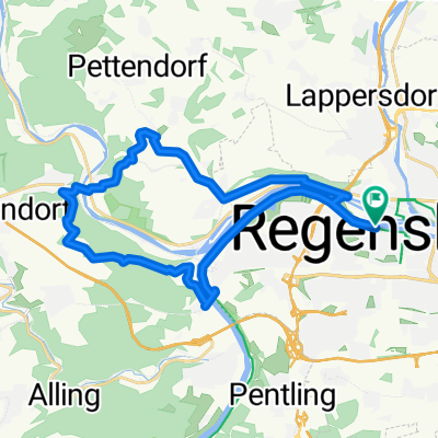
D10b Regensburg to Wörth an der Donau (Germany)
A cycling route starting in Regensburg, Bavaria, Germany.
Overview
About this route
- -:--
- Duration
- 26.6 km
- Distance
- 53 m
- Ascent
- 48 m
- Descent
- ---
- Avg. speed
- 340 m
- Max. altitude

Part of
Route quality
Waytypes & surfaces along the route
Waytypes
Quiet road
11.7 km
(44 %)
Track
4.2 km
(16 %)
Surfaces
Paved
23.6 km
(89 %)
Asphalt
23.6 km
(89 %)
Undefined
2.9 km
(11 %)
Route highlights
Points of interest along the route
\"")
Point of interest after 11 km
The Walhalla rises above the Danube near Regensburg. https://www.schloesser.bayern.de/deutsch/schloss/objekte/walhalla.htm
Continue with Bikemap
Use, edit, or download this cycling route
You would like to ride D10b Regensburg to Wörth an der Donau (Germany) or customize it for your own trip? Here is what you can do with this Bikemap route:
Free features
- Save this route as favorite or in collections
- Copy & plan your own version of this route
- Sync your route with Garmin or Wahoo
Premium features
Free trial for 3 days, or one-time payment. More about Bikemap Premium.
- Navigate this route on iOS & Android
- Export a GPX / KML file of this route
- Create your custom printout (try it for free)
- Download this route for offline navigation
Discover more Premium features.
Get Bikemap PremiumFrom our community
Other popular routes starting in Regensburg
 Mittlere Tour Regensburg - Donau und zurück
- Distance
- 20.7 km
- Ascent
- 222 m
- Descent
- 182 m
- Location
- Regensburg, Bavaria, Germany
 Fünf-Flüsse-Radtour mit Start in Regensburg
- Distance
- 308.4 km
- Ascent
- 2,967 m
- Descent
- 3,006 m
- Location
- Regensburg, Bavaria, Germany
 Regensburg-Bad Abbach
- Distance
- 40 km
- Ascent
- 268 m
- Descent
- 269 m
- Location
- Regensburg, Bavaria, Germany
 Donau - Laber Tour über Lindach
- Distance
- 44.6 km
- Ascent
- 435 m
- Descent
- 433 m
- Location
- Regensburg, Bavaria, Germany
 Der Norden Regensburgs
- Distance
- 105.3 km
- Ascent
- 535 m
- Descent
- 536 m
- Location
- Regensburg, Bavaria, Germany
 Rgbg-Marienhöhe-Etterzhausen-Adlersberg-Rgbg
- Distance
- 25.2 km
- Ascent
- 274 m
- Descent
- 274 m
- Location
- Regensburg, Bavaria, Germany
 Regensburg Altenthann + zurück
- Distance
- 43.2 km
- Ascent
- 530 m
- Descent
- 538 m
- Location
- Regensburg, Bavaria, Germany
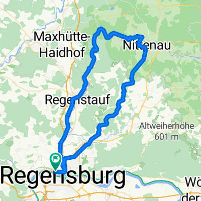 Rundkurs Nittenau --> Kürn --> Regensburg
- Distance
- 66.6 km
- Ascent
- 769 m
- Descent
- 719 m
- Location
- Regensburg, Bavaria, Germany
Open it in the app