

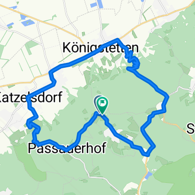
Etappe16
A cycling route starting in Tulbing, Lower Austria, Austria.
Overview
About this route
Wolfgang Amadeus Mozart left numerous traces around Salzburg. A mosaic of historically documented 'Mozart points' is connected by the Mozart cycling route. This cross-border cycling route runs right through the most magnificent lake landscapes in Salzburg and Bavaria.
- -:--
- Duration
- 26 km
- Distance
- 215 m
- Ascent
- 325 m
- Descent
- ---
- Avg. speed
- ---
- Max. altitude
Route quality
Waytypes & surfaces along the route
Waytypes
Road
9.6 km
(37 %)
Quiet road
6.8 km
(26 %)
Surfaces
Paved
15.3 km
(59 %)
Unpaved
0.3 km
(1 %)
Asphalt
13.8 km
(53 %)
Concrete
1 km
(4 %)
Continue with Bikemap
Use, edit, or download this cycling route
You would like to ride Etappe16 or customize it for your own trip? Here is what you can do with this Bikemap route:
Free features
- Save this route as favorite or in collections
- Copy & plan your own version of this route
- Sync your route with Garmin or Wahoo
Premium features
Free trial for 3 days, or one-time payment. More about Bikemap Premium.
- Navigate this route on iOS & Android
- Export a GPX / KML file of this route
- Create your custom printout (try it for free)
- Download this route for offline navigation
Discover more Premium features.
Get Bikemap PremiumFrom our community
Other popular routes starting in Tulbing
 Trainingsrunde 21.04.2014
- Distance
- 25.6 km
- Ascent
- 52 m
- Descent
- 52 m
- Location
- Tulbing, Lower Austria, Austria
 Wilfersdorf - Hollabrunn - Laa/Thaya
- Distance
- 85.1 km
- Ascent
- 520 m
- Descent
- 561 m
- Location
- Tulbing, Lower Austria, Austria
 Donauland bis am Wagram
- Distance
- 67.5 km
- Ascent
- 209 m
- Descent
- 90 m
- Location
- Tulbing, Lower Austria, Austria
 MTB durch den nahen Wienerwald und an der Donau zurück
- Distance
- 67.2 km
- Ascent
- 771 m
- Descent
- 771 m
- Location
- Tulbing, Lower Austria, Austria
 Tulbinger-Kogel-Runde
- Distance
- 20.8 km
- Ascent
- 394 m
- Descent
- 392 m
- Location
- Tulbing, Lower Austria, Austria
 T8 Freundorf Runde
- Distance
- 19.3 km
- Ascent
- 75 m
- Descent
- 75 m
- Location
- Tulbing, Lower Austria, Austria
 Samstag_06_05_23
- Distance
- 76.1 km
- Ascent
- 1,088 m
- Descent
- 1,134 m
- Location
- Tulbing, Lower Austria, Austria
 Etappe16
- Distance
- 26 km
- Ascent
- 215 m
- Descent
- 325 m
- Location
- Tulbing, Lower Austria, Austria
Open it in the app