

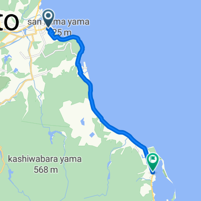
淡路島半周464
A cycling route starting in Sumoto, Hyōgo, Japan.
Overview
About this route
- -:--
- Duration
- 54.7 km
- Distance
- 205 m
- Ascent
- 203 m
- Descent
- ---
- Avg. speed
- ---
- Max. altitude
Route quality
Waytypes & surfaces along the route
Waytypes
Quiet road
16.9 km
(31 %)
Cycleway
10.4 km
(19 %)
Surfaces
Paved
1.6 km
(3 %)
Asphalt
1.1 km
(2 %)
Paved (undefined)
0.5 km
(1 %)
Undefined
53 km
(97 %)
Continue with Bikemap
Use, edit, or download this cycling route
You would like to ride 淡路島半周464 or customize it for your own trip? Here is what you can do with this Bikemap route:
Free features
- Save this route as favorite or in collections
- Copy & plan your own version of this route
- Sync your route with Garmin or Wahoo
Premium features
Free trial for 3 days, or one-time payment. More about Bikemap Premium.
- Navigate this route on iOS & Android
- Export a GPX / KML file of this route
- Create your custom printout (try it for free)
- Download this route for offline navigation
Discover more Premium features.
Get Bikemap PremiumFrom our community
Other popular routes starting in Sumoto
 Akashi kobe - Sumoto
- Distance
- 49 km
- Ascent
- 562 m
- Descent
- 635 m
- Location
- Sumoto, Hyōgo, Japan
 Route in Osaka
- Distance
- 9.7 km
- Ascent
- 207 m
- Descent
- 198 m
- Location
- Sumoto, Hyōgo, Japan
 淡路島 妙見山
- Distance
- 26.9 km
- Ascent
- 601 m
- Descent
- 604 m
- Location
- Sumoto, Hyōgo, Japan
 awaji 1
- Distance
- 11.6 km
- Ascent
- 207 m
- Descent
- 200 m
- Location
- Sumoto, Hyōgo, Japan
 awajishima round
- Distance
- 148.3 km
- Ascent
- 592 m
- Descent
- 592 m
- Location
- Sumoto, Hyōgo, Japan
 251−14, 洲本市 to 251−14, 洲本市
- Distance
- 86.2 km
- Ascent
- 1,200 m
- Descent
- 1,199 m
- Location
- Sumoto, Hyōgo, Japan
 淡路島横断
淡路島横断- Distance
- 7.9 km
- Ascent
- 55 m
- Descent
- 57 m
- Location
- Sumoto, Hyōgo, Japan
 1755, Ikuho, Awaji to 国道28号, Awaji
- Distance
- 153 km
- Ascent
- 6 m
- Descent
- 18 m
- Location
- Sumoto, Hyōgo, Japan
Open it in the app