

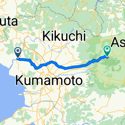
1361-3, Yamada, Tamana-Shi to 1361-3, Yamada, Tamana-Shi
A cycling route starting in Tamana, Kumamoto, Japan.
Overview
About this route
- 5 min
- Duration
- 0.2 km
- Distance
- 17 m
- Ascent
- 32 m
- Descent
- 2.6 km/h
- Avg. speed
- ---
- Max. altitude
Route quality
Waytypes & surfaces along the route
Waytypes
Quiet road
0.2 km
(73 %)
Access road
0.1 km
(27 %)
Continue with Bikemap
Use, edit, or download this cycling route
You would like to ride 1361-3, Yamada, Tamana-Shi to 1361-3, Yamada, Tamana-Shi or customize it for your own trip? Here is what you can do with this Bikemap route:
Free features
- Save this route as favorite or in collections
- Copy & plan your own version of this route
- Sync your route with Garmin or Wahoo
Premium features
Free trial for 3 days, or one-time payment. More about Bikemap Premium.
- Navigate this route on iOS & Android
- Export a GPX / KML file of this route
- Create your custom printout (try it for free)
- Download this route for offline navigation
Discover more Premium features.
Get Bikemap PremiumFrom our community
Other popular routes starting in Tamana
 일본여행 7일차
- Distance
- 58.9 km
- Ascent
- 1,025 m
- Descent
- 510 m
- Location
- Tamana, Kumamoto, Japan
 1361-3, Yamada, Tamana-Shi to 1361-3, Yamada, Tamana-Shi
- Distance
- 0.2 km
- Ascent
- 17 m
- Descent
- 32 m
- Location
- Tamana, Kumamoto, Japan
 1361-8, Yamada, Tamana-Shi to 1361-8, Yamada, Tamana-Shi
- Distance
- 0.2 km
- Ascent
- 0 m
- Descent
- 0 m
- Location
- Tamana, Kumamoto, Japan
 1361-3, Yamada, Tamana to 1361-3, Yamada, Tamana
- Distance
- 123.1 km
- Ascent
- 2,497 m
- Descent
- 2,496 m
- Location
- Tamana, Kumamoto, Japan
 Tamana to Tankaino campsite
- Distance
- 65.7 km
- Ascent
- 549 m
- Descent
- 759 m
- Location
- Tamana, Kumamoto, Japan
Open it in the app