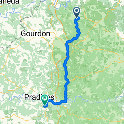
ETAPE N°03
A cycling route starting in Gramat, Languedoc-Roussillon-Midi-Pyrénées, France.
Overview
About this route
- -:--
- Duration
- 68.9 km
- Distance
- 512 m
- Ascent
- 659 m
- Descent
- ---
- Avg. speed
- ---
- Max. altitude
Route quality
Waytypes & surfaces along the route
Waytypes
Road
36.6 km
(53 %)
Quiet road
22.7 km
(33 %)
Surfaces
Paved
7 km
(10 %)
Unpaved
1.3 km
(2 %)
Asphalt
7 km
(10 %)
Gravel
1.3 km
(2 %)
Undefined
60.6 km
(88 %)
Route highlights
Points of interest along the route
Point of interest after 39.9 km
CABRERETS
Point of interest after 43.8 km
GROTTE DE PECHE MERLE
Point of interest after 60.2 km
SAINT-CIRCQ-LA-POPIE
Continue with Bikemap
Use, edit, or download this cycling route
You would like to ride ETAPE N°03 or customize it for your own trip? Here is what you can do with this Bikemap route:
Free features
- Save this route as favorite or in collections
- Copy & plan your own version of this route
- Sync your route with Garmin or Wahoo
Premium features
Free trial for 3 days, or one-time payment. More about Bikemap Premium.
- Navigate this route on iOS & Android
- Export a GPX / KML file of this route
- Create your custom printout (try it for free)
- Download this route for offline navigation
Discover more Premium features.
Get Bikemap PremiumFrom our community
Other popular routes starting in Gramat
- Chemin de la Jamonne 860, Carlucet nach D673, Rocamadour
- Distance
- 9.8 km
- Ascent
- 187 m
- Descent
- 340 m
- Location
- Gramat, Languedoc-Roussillon-Midi-Pyrénées, France
- Rignac - Rocamadour
- Distance
- 15.6 km
- Ascent
- 200 m
- Descent
- 173 m
- Location
- Gramat, Languedoc-Roussillon-Midi-Pyrénées, France
- ETAPE N°03
- Distance
- 68.9 km
- Ascent
- 512 m
- Descent
- 659 m
- Location
- Gramat, Languedoc-Roussillon-Midi-Pyrénées, France
- J7 via Meyronne Long
- Distance
- 85.9 km
- Ascent
- 1,352 m
- Descent
- 1,310 m
- Location
- Gramat, Languedoc-Roussillon-Midi-Pyrénées, France
- Périgord 3 - Rocamadour > Martel
- Distance
- 66.3 km
- Ascent
- 477 m
- Descent
- 425 m
- Location
- Gramat, Languedoc-Roussillon-Midi-Pyrénées, France
- Dordogne 20130711
- Distance
- 82.6 km
- Ascent
- 831 m
- Descent
- 1,025 m
- Location
- Gramat, Languedoc-Roussillon-Midi-Pyrénées, France
- Rocamadour to Gramat Station
- Distance
- 16.6 km
- Ascent
- 324 m
- Descent
- 260 m
- Location
- Gramat, Languedoc-Roussillon-Midi-Pyrénées, France
- De Route de la Cité 108, Rocamadour a Rue du Four 6, Gramat
- Distance
- 11.1 km
- Ascent
- 147 m
- Descent
- 137 m
- Location
- Gramat, Languedoc-Roussillon-Midi-Pyrénées, France
Open it in the app