

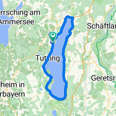
Maistättenweiher-Runde
A cycling route starting in Feldafing, Bavaria, Germany.
Overview
About this route
- -:--
- Duration
- 38.6 km
- Distance
- 458 m
- Ascent
- 457 m
- Descent
- ---
- Avg. speed
- ---
- Avg. speed

Continue with Bikemap
Use, edit, or download this cycling route
You would like to ride Maistättenweiher-Runde or customize it for your own trip? Here is what you can do with this Bikemap route:
Free features
- Save this route as favorite or in collections
- Copy & plan your own version of this route
- Sync your route with Garmin or Wahoo
Premium features
Free trial for 3 days, or one-time payment. More about Bikemap Premium.
- Navigate this route on iOS & Android
- Export a GPX / KML file of this route
- Create your custom printout (try it for free)
- Download this route for offline navigation
Discover more Premium features.
Get Bikemap PremiumFrom our community
Other popular routes starting in Feldafing
 2-Schluchten-Runde
- Distance
- 23 km
- Ascent
- 141 m
- Descent
- 141 m
- Location
- Feldafing, Bavaria, Germany
 Seeumrundung Starnberg
- Distance
- 53.8 km
- Ascent
- 259 m
- Descent
- 262 m
- Location
- Feldafing, Bavaria, Germany
 Maistättenweiher-Runde
- Distance
- 38.6 km
- Ascent
- 458 m
- Descent
- 457 m
- Location
- Feldafing, Bavaria, Germany
 Starnbergersee
- Distance
- 52.2 km
- Ascent
- 166 m
- Descent
- 179 m
- Location
- Feldafing, Bavaria, Germany
 Lange Radrunde durch Feldafing
- Distance
- 59.6 km
- Ascent
- 362 m
- Descent
- 360 m
- Location
- Feldafing, Bavaria, Germany
 Bahnhofstraße 41, Feldafing nach Kirchplatz 13, Weilheim in OB
- Distance
- 28 km
- Ascent
- 3,177 m
- Descent
- 3,266 m
- Location
- Feldafing, Bavaria, Germany
 Morgenrunde
- Distance
- 33.9 km
- Ascent
- 174 m
- Descent
- 174 m
- Location
- Feldafing, Bavaria, Germany
 Route in Feldafing
- Distance
- 24.8 km
- Ascent
- 302 m
- Descent
- 312 m
- Location
- Feldafing, Bavaria, Germany
Open it in the app