

Mendel-, Gampenpass, Montiggler See
A cycling route starting in San Michele, Trentino-Alto Adige, Italy.
Overview
About this route
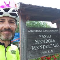
Eppan - Mendelpass - Fondo - Gampenpass - Terlan - Eppan - Montiggler See - Eppan
- -:--
- Duration
- 80.7 km
- Distance
- 2,467 m
- Ascent
- 2,417 m
- Descent
- ---
- Avg. speed
- 1,534 m
- Max. altitude

Route quality
Waytypes & surfaces along the route
Waytypes
Road
12.1 km
(15 %)
Quiet road
8.9 km
(11 %)
Surfaces
Paved
71 km
(88 %)
Unpaved
0.8 km
(1 %)
Asphalt
71 km
(88 %)
Gravel
0.8 km
(1 %)
Undefined
8.9 km
(11 %)
Continue with Bikemap
Use, edit, or download this cycling route
You would like to ride Mendel-, Gampenpass, Montiggler See or customize it for your own trip? Here is what you can do with this Bikemap route:
Free features
- Save this route as favorite or in collections
- Copy & plan your own version of this route
- Split it into stages to create a multi-day tour
- Sync your route with Garmin or Wahoo
Premium features
Free trial for 3 days, or one-time payment. More about Bikemap Premium.
- Navigate this route on iOS & Android
- Export a GPX / KML file of this route
- Create your custom printout (try it for free)
- Download this route for offline navigation
Discover more Premium features.
Get Bikemap PremiumFrom our community
Other popular routes starting in San Michele
 Eppan Gampen Mendel
- Distance
- 69.7 km
- Ascent
- 2,212 m
- Descent
- 2,209 m
- Location
- San Michele, Trentino-Alto Adige, Italy
 MENDELPASS/ PASSO DELLA MENDOLA + PENEGAL (por Sopra di Sotto)
- Distance
- 19.4 km
- Ascent
- 1,755 m
- Descent
- 440 m
- Location
- San Michele, Trentino-Alto Adige, Italy
 Montiggl Di1
- Distance
- 15.3 km
- Ascent
- 498 m
- Descent
- 495 m
- Location
- San Michele, Trentino-Alto Adige, Italy
 Mendel-, Gampenpass, Montiggler See
- Distance
- 80.7 km
- Ascent
- 2,467 m
- Descent
- 2,417 m
- Location
- San Michele, Trentino-Alto Adige, Italy
 Badetour zum Montiggler See
- Distance
- 11.2 km
- Ascent
- 236 m
- Descent
- 193 m
- Location
- San Michele, Trentino-Alto Adige, Italy
 MTB-Tour durch den Montiggler Wald
- Distance
- 19.3 km
- Ascent
- 0 m
- Descent
- 0 m
- Location
- San Michele, Trentino-Alto Adige, Italy
 Perdoing/Gaid
- Distance
- 27.8 km
- Ascent
- 797 m
- Descent
- 797 m
- Location
- San Michele, Trentino-Alto Adige, Italy
 Tour Strada del Vino e Bolzano
- Distance
- 50.1 km
- Ascent
- 363 m
- Descent
- 363 m
- Location
- San Michele, Trentino-Alto Adige, Italy
Open it in the app