

Clough Road 2135, Revelstoke to Unnamed Road, Revelstoke
A cycling route starting in Revelstoke, British Columbia, Canada.
Overview
About this route
- 2 h 9 min
- Duration
- 19.3 km
- Distance
- 144 m
- Ascent
- 287 m
- Descent
- 9 km/h
- Avg. speed
- ---
- Max. altitude

Continue with Bikemap
Use, edit, or download this cycling route
You would like to ride Clough Road 2135, Revelstoke to Unnamed Road, Revelstoke or customize it for your own trip? Here is what you can do with this Bikemap route:
Free features
- Save this route as favorite or in collections
- Copy & plan your own version of this route
- Sync your route with Garmin or Wahoo
Premium features
Free trial for 3 days, or one-time payment. More about Bikemap Premium.
- Navigate this route on iOS & Android
- Export a GPX / KML file of this route
- Create your custom printout (try it for free)
- Download this route for offline navigation
Discover more Premium features.
Get Bikemap PremiumFrom our community
Other popular routes starting in Revelstoke
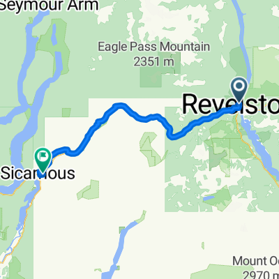 Revelstoke-sicamous
- Distance
- 75.9 km
- Ascent
- 333 m
- Descent
- 423 m
- Location
- Revelstoke, British Columbia, Canada
 12-09-10 Kanada: Upper Arrow Lake-Galena Bay-(Fähre)-Shelter Bay-Halcyon Hot Springs
- Distance
- 50 km
- Ascent
- 506 m
- Descent
- 612 m
- Location
- Revelstoke, British Columbia, Canada
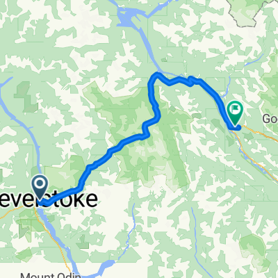
 Trans-Canada Highway, Revelstoke to Clough Road 2135, Revelstoke
- Distance
- 6.9 km
- Ascent
- 202 m
- Descent
- 75 m
- Location
- Revelstoke, British Columbia, Canada
 Revelstoke to Golden
- Distance
- 151.4 km
- Ascent
- 1,609 m
- Descent
- 1,279 m
- Location
- Revelstoke, British Columbia, Canada
 从304 3rd St W, 雷维斯托克出发的路线
- Distance
- 152.1 km
- Ascent
- 2,431 m
- Descent
- 1,970 m
- Location
- Revelstoke, British Columbia, Canada
 900 Moss St, Revelstoke to 813 Silver Ave, Revelstoke
- Distance
- 3.9 km
- Ascent
- 29 m
- Descent
- 13 m
- Location
- Revelstoke, British Columbia, Canada
 R19RevSalArm
- Distance
- 106.6 km
- Ascent
- 516 m
- Descent
- 613 m
- Location
- Revelstoke, British Columbia, Canada
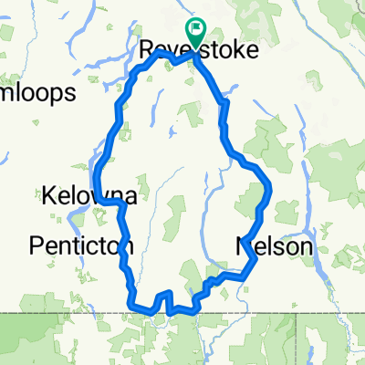 Around my Rockies 2011
- Distance
- 731.8 km
- Ascent
- 3,334 m
- Descent
- 3,334 m
- Location
- Revelstoke, British Columbia, Canada
Open it in the app