

2022 - Ruta nº 042
A cycling route starting in Valladolid, Castille and León, Spain.
Overview
About this route
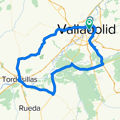
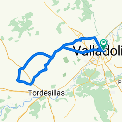
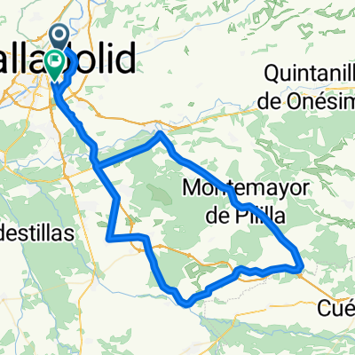
Renedo - Piña - Esguevillas - Amusquillo - Encinas - Corrales - Valdearcos - Bocos - Pesquera - Valbuena - Olivares - Villabañez - Renedo - Valladolid
1st Climb: Altitude: Matas Altas
Average gradient 3.70%
Distance 2.8 Km.
2nd Climb: Páramo Rozas del Duero (2)
Average gradient 5.30%
Distance 2.3 Km.
3rd Climb: Canteras (2)
Average gradient 5.50%
Distance 2.6 Km.
- -:--
- Duration
- 134.4 km
- Distance
- 714 m
- Ascent
- 715 m
- Descent
- ---
- Avg. speed
- 911 m
- Max. altitude

Route quality
Waytypes & surfaces along the route
Waytypes
Road
71.2 km
(53 %)
Cycleway
4 km
(3 %)
Surfaces
Paved
119.6 km
(89 %)
Asphalt
119.6 km
(89 %)
Undefined
14.8 km
(11 %)
Route highlights
Points of interest along the route
Point of interest after 57.7 km
Subida: Alto: Matas Altas Pendiente media 3,70% Distancia 2,8 Km.
Point of interest after 105.9 km
Subida: Páramo Rozas del Duero (2) Pendiente media 5,30% Distancia 2,3 Km.
Point of interest after 118.8 km
Subida: Canteras (2) Pendiente media 5,50% Distancia 2,6 Km.
Continue with Bikemap
Use, edit, or download this cycling route
You would like to ride 2022 - Ruta nº 042 or customize it for your own trip? Here is what you can do with this Bikemap route:
Free features
- Save this route as favorite or in collections
- Copy & plan your own version of this route
- Split it into stages to create a multi-day tour
- Sync your route with Garmin or Wahoo
Premium features
Free trial for 3 days, or one-time payment. More about Bikemap Premium.
- Navigate this route on iOS & Android
- Export a GPX / KML file of this route
- Create your custom printout (try it for free)
- Download this route for offline navigation
Discover more Premium features.
Get Bikemap PremiumFrom our community
Other popular routes starting in Valladolid
 2022 - Ruta nº 096
- Distance
- 97.2 km
- Ascent
- 2,072 m
- Descent
- 2,072 m
- Location
- Valladolid, Castille and León, Spain
 Circuito: VAREVITUCI
- Distance
- 37.6 km
- Ascent
- 303 m
- Descent
- 303 m
- Location
- Valladolid, Castille and León, Spain
 2022 Ruta Nº 083
- Distance
- 83.7 km
- Ascent
- 358 m
- Descent
- 359 m
- Location
- Valladolid, Castille and León, Spain
 2022 - Ruta nº 073
- Distance
- 101.3 km
- Ascent
- 730 m
- Descent
- 732 m
- Location
- Valladolid, Castille and León, Spain
 2018 - Ruta nº 032
- Distance
- 74.4 km
- Ascent
- 220 m
- Descent
- 220 m
- Location
- Valladolid, Castille and León, Spain
 Circuito: (Casasola Valladolid)
- Distance
- 14.2 km
- Ascent
- 47 m
- Descent
- 46 m
- Location
- Valladolid, Castille and León, Spain
 2022 Ruta Nº 065
- Distance
- 99.9 km
- Ascent
- 711 m
- Descent
- 715 m
- Location
- Valladolid, Castille and León, Spain
 2022 - Ruta nº 051
- Distance
- 113.5 km
- Ascent
- 833 m
- Descent
- 829 m
- Location
- Valladolid, Castille and León, Spain
Open it in the app