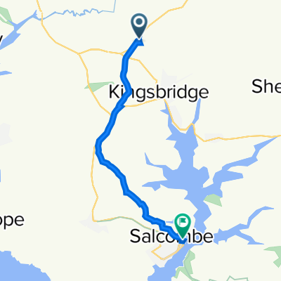
Kingsbridge, Prawle, Slapton 30 miles
A cycling route starting in Kingsbridge, England, United Kingdom.
Overview
About this route
- -:--
- Duration
- 47.7 km
- Distance
- 721 m
- Ascent
- 724 m
- Descent
- ---
- Avg. speed
- ---
- Max. altitude
Route quality
Waytypes & surfaces along the route
Waytypes
Quiet road
31.9 km
(67 %)
Road
9.1 km
(19 %)
Surfaces
Paved
17.4 km
(37 %)
Unpaved
2.1 km
(4 %)
Asphalt
17.3 km
(36 %)
Ground
2.1 km
(4 %)
Continue with Bikemap
Use, edit, or download this cycling route
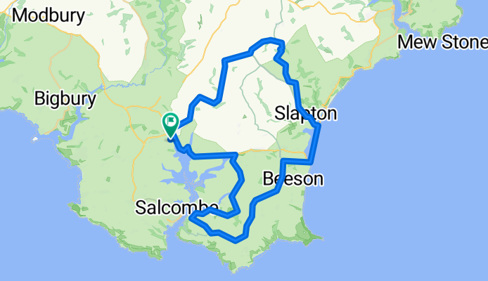
You would like to ride Kingsbridge, Prawle, Slapton 30 miles or customize it for your own trip? Here is what you can do with this Bikemap route:
Free features
- Save this route as favorite or in collections
- Copy & plan your own version of this route
- Sync your route with Garmin or Wahoo
Premium features
Free trial for 3 days, or one-time payment. More about Bikemap Premium.
- Navigate this route on iOS & Android
- Export a GPX / KML file of this route
- Create your custom printout (try it for free)
- Download this route for offline navigation
Discover more Premium features.
Get Bikemap PremiumFrom our community
Other popular routes starting in Kingsbridge
- Kingsbridge, Prawle, Slapton 30 miles
- Distance
- 47.7 km
- Ascent
- 721 m
- Descent
- 724 m
- Location
- Kingsbridge, England, United Kingdom
- Parkland, Kingsbridge to The Haven, Kingsbridge
- Distance
- 14.5 km
- Ascent
- 324 m
- Descent
- 429 m
- Location
- Kingsbridge, England, United Kingdom
- Aveton to Salcombe
- Distance
- 13.8 km
- Ascent
- 280 m
- Descent
- 263 m
- Location
- Kingsbridge, England, United Kingdom
- Recovered Route
- Distance
- 2.3 km
- Ascent
- 34 m
- Descent
- 74 m
- Location
- Kingsbridge, England, United Kingdom
- A381, Churchstow, Kingsbridge to 4 The Quay, Dartmouth
- Distance
- 21.6 km
- Ascent
- 1,363 m
- Descent
- 1,454 m
- Location
- Kingsbridge, England, United Kingdom
- Parkland to Milton Sands
- Distance
- 8.5 km
- Ascent
- 89 m
- Descent
- 188 m
- Location
- Kingsbridge, England, United Kingdom
- Route to A381, Churchstow, Kingsbridge
- Distance
- 7.2 km
- Ascent
- 31 m
- Descent
- 93 m
- Location
- Kingsbridge, England, United Kingdom
- A381, Churchstow, Kingsbridge to Harbour Master Office, Fore St, Salcombe
- Distance
- 9.8 km
- Ascent
- 205 m
- Descent
- 313 m
- Location
- Kingsbridge, England, United Kingdom
Open it in the app