

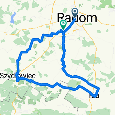
powrót z wschodnim wiatrem
A cycling route starting in Radom, Masovian Voivodeship, Poland.
Overview
About this route
- -:--
- Duration
- 110.4 km
- Distance
- 201 m
- Ascent
- 201 m
- Descent
- ---
- Avg. speed
- ---
- Max. altitude

Route quality
Waytypes & surfaces along the route
Waytypes
Road
50.8 km
(46 %)
Quiet road
19.9 km
(18 %)
Surfaces
Paved
65.1 km
(59 %)
Unpaved
4.4 km
(4 %)
Asphalt
60.7 km
(55 %)
Paved (undefined)
4.4 km
(4 %)
Continue with Bikemap
Use, edit, or download this cycling route
You would like to ride powrót z wschodnim wiatrem or customize it for your own trip? Here is what you can do with this Bikemap route:
Free features
- Save this route as favorite or in collections
- Copy & plan your own version of this route
- Split it into stages to create a multi-day tour
- Sync your route with Garmin or Wahoo
Premium features
Free trial for 3 days, or one-time payment. More about Bikemap Premium.
- Navigate this route on iOS & Android
- Export a GPX / KML file of this route
- Create your custom printout (try it for free)
- Download this route for offline navigation
Discover more Premium features.
Get Bikemap PremiumFrom our community
Other popular routes starting in Radom
 CoZaJAzda Ultra 2025
- Distance
- 106.2 km
- Ascent
- 449 m
- Descent
- 422 m
- Location
- Radom, Masovian Voivodeship, Poland
 200 krzyz
- Distance
- 198.7 km
- Ascent
- 1,591 m
- Descent
- 1,481 m
- Location
- Radom, Masovian Voivodeship, Poland
 Królewskie Żródła
- Distance
- 76.6 km
- Ascent
- 156 m
- Descent
- 155 m
- Location
- Radom, Masovian Voivodeship, Poland
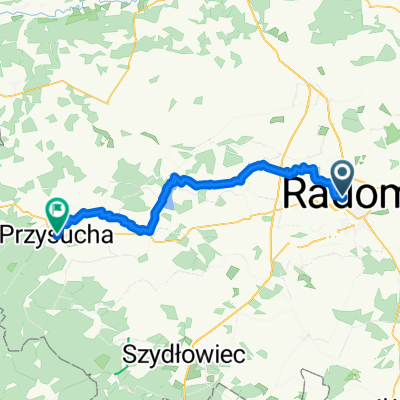 CoZaJazda 2025 - Przysucha via Krawczyk asfalt
- Distance
- 52.6 km
- Ascent
- 202 m
- Descent
- 144 m
- Location
- Radom, Masovian Voivodeship, Poland
 Radom 50km
- Distance
- 50.3 km
- Ascent
- 276 m
- Descent
- 276 m
- Location
- Radom, Masovian Voivodeship, Poland
 CoZaJazda 2025 Garbatka
- Distance
- 46.4 km
- Ascent
- 169 m
- Descent
- 173 m
- Location
- Radom, Masovian Voivodeship, Poland
 leśna trasa
- Distance
- 61.2 km
- Ascent
- 157 m
- Descent
- 154 m
- Location
- Radom, Masovian Voivodeship, Poland
 50tka
50tka- Distance
- 51 km
- Ascent
- 115 m
- Descent
- 118 m
- Location
- Radom, Masovian Voivodeship, Poland
Open it in the app