

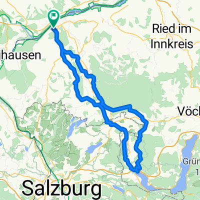
2020-W12 Katzenberg
A cycling route starting in Braunau am Inn, Upper Austria, Austria.
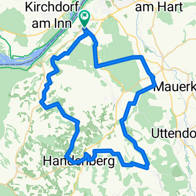
Overview
About this route
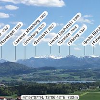
20200814_160712
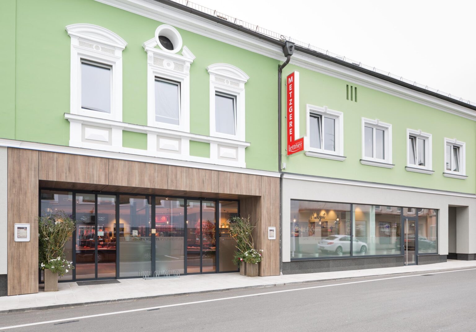
GH Schloßtaverne http://www.schlosstaverne-katzenberg.at/
- -:--
- Duration
- 65.9 km
- Distance
- 549 m
- Ascent
- 904 m
- Descent
- ---
- Avg. speed
- 417 m
- Max. altitude

Route photos

Route quality
Waytypes & surfaces along the route
Waytypes
Quiet road
33.6 km
(51 %)
Road
7.9 km
(12 %)
Surfaces
Paved
10.5 km
(16 %)
Unpaved
2.6 km
(4 %)
Asphalt
10.5 km
(16 %)
Gravel
2 km
(3 %)
Route highlights
Points of interest along the route
Point of interest after 37.8 km
GH Schloßtaverne http://www.schlosstaverne-katzenberg.at/
Continue with Bikemap
Use, edit, or download this cycling route
You would like to ride 2020-W12 Katzenberg or customize it for your own trip? Here is what you can do with this Bikemap route:
Free features
- Save this route as favorite or in collections
- Copy & plan your own version of this route
- Sync your route with Garmin or Wahoo
Premium features
Free trial for 3 days, or one-time payment. More about Bikemap Premium.
- Navigate this route on iOS & Android
- Export a GPX / KML file of this route
- Create your custom printout (try it for free)
- Download this route for offline navigation
Discover more Premium features.
Get Bikemap PremiumFrom our community
Other popular routes starting in Braunau am Inn
 2025-W20 Sör Hans
- Distance
- 45.8 km
- Ascent
- 344 m
- Descent
- 350 m
- Location
- Braunau am Inn, Upper Austria, Austria
 2025-P07Altheim Metzg. Lettner
- Distance
- 51.4 km
- Ascent
- 289 m
- Descent
- 289 m
- Location
- Braunau am Inn, Upper Austria, Austria
 2025-W07 St. Veit
- Distance
- 55.5 km
- Ascent
- 321 m
- Descent
- 324 m
- Location
- Braunau am Inn, Upper Austria, Austria
 2020-W09 Höhnhart
- Distance
- 69.2 km
- Ascent
- 3,139 m
- Descent
- 3,139 m
- Location
- Braunau am Inn, Upper Austria, Austria
 2025-W14 Eggenfelden🇩🇪
- Distance
- 75.4 km
- Ascent
- 762 m
- Descent
- 763 m
- Location
- Braunau am Inn, Upper Austria, Austria
 2021-E02 Buchberg
- Distance
- 92.4 km
- Ascent
- 4,379 m
- Descent
- 4,020 m
- Location
- Braunau am Inn, Upper Austria, Austria
 Lange Radrunde durch Braunau am Inn
- Distance
- 50 km
- Ascent
- 225 m
- Descent
- 225 m
- Location
- Braunau am Inn, Upper Austria, Austria
 2025-P09 Mondseeberg
- Distance
- 132.8 km
- Ascent
- 1,395 m
- Descent
- 1,392 m
- Location
- Braunau am Inn, Upper Austria, Austria
Open it in the app