

Vyjazd BTVT 22. - 24. 8. 2008
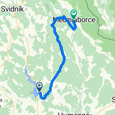
A cycling route starting in Vranov nad Topľou, Prešov Region, Slovakia.
Overview
About this route
2
- -:--
- Duration
- 337.8 km
- Distance
- 3,145 m
- Ascent
- 3,074 m
- Descent
- ---
- Avg. speed
- 1,020 m
- Max. altitude
Route quality
Waytypes & surfaces along the route
Waytypes
Road
27 km
8 %
Quiet road
27 km
8 %
Surfaces
Paved
155.4 km
(46 %)
Unpaved
3.4 km
(1 %)
Asphalt
155.4 km
46 %
Ground
3.4 km
1 %
Undefined
179 km
53 %
Continue with Bikemap
Use, edit, or download this cycling route
You would like to ride Vyjazd BTVT 22. - 24. 8. 2008 or customize it for your own trip? Here is what you can do with this Bikemap route:
Free features
- Save this route as favorite or in collections
- Copy & plan your own version of this route
- Split it into stages to create a multi-day tour
- Sync your route with Garmin or Wahoo
Premium features
Free trial for 3 days, or one-time payment. More about Bikemap Premium.
- Navigate this route on iOS & Android
- Export a GPX / KML file of this route
- Create your custom printout (try it for free)
- Download this route for offline navigation
Discover more Premium features.
Get Bikemap PremiumFrom our community
Other popular routes starting in Vranov nad Topľou


Open it in the app