

Payerbach-Baden ueber Hubertussee
A cycling route starting in Payerbach, Lower Austria, Austria.
Overview
About this route
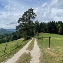
For road cyclists. Start is at Payerbach train station. Over Preiner Gscheid, the upper Mürztal valley to Lahnsattel. Halltal, through Walstern over Ulrichsberg to Gscheid. Kernhof, St. Ägid, Ochssattel, Kalte Kuchl, Rohr, Haselrast, Guttenstein, Pernitz, Hals, Pottenstein, Grossau, Bad Vöslau to Baden train station. Exclusively roads - practically NO forced happiness of bike paths (!!!!). 9 more or less high crossings.
- -:--
- Duration
- 169.5 km
- Distance
- 1,616 m
- Ascent
- 1,877 m
- Descent
- ---
- Avg. speed
- ---
- Max. altitude

Route quality
Waytypes & surfaces along the route
Waytypes
Quiet road
18.6 km
(11 %)
Road
13.6 km
(8 %)
Surfaces
Paved
89.8 km
(53 %)
Unpaved
1.7 km
(1 %)
Asphalt
89.8 km
(53 %)
Gravel
1.7 km
(1 %)
Undefined
77.9 km
(46 %)
Continue with Bikemap
Use, edit, or download this cycling route
You would like to ride Payerbach-Baden ueber Hubertussee or customize it for your own trip? Here is what you can do with this Bikemap route:
Free features
- Save this route as favorite or in collections
- Copy & plan your own version of this route
- Split it into stages to create a multi-day tour
- Sync your route with Garmin or Wahoo
Premium features
Free trial for 3 days, or one-time payment. More about Bikemap Premium.
- Navigate this route on iOS & Android
- Export a GPX / KML file of this route
- Create your custom printout (try it for free)
- Download this route for offline navigation
Discover more Premium features.
Get Bikemap PremiumFrom our community
Other popular routes starting in Payerbach
 Kreuzbergstecke vom Bahnhof Payerbach-Reichenau (Ohne Singletrails)
- Distance
- 32.4 km
- Ascent
- 1,143 m
- Descent
- 1,143 m
- Location
- Payerbach, Lower Austria, Austria
 Rund um die Rax
- Distance
- 126.9 km
- Ascent
- 1,240 m
- Descent
- 1,241 m
- Location
- Payerbach, Lower Austria, Austria
 Trainingsstrecke über Speckbacherhütte
- Distance
- 33.5 km
- Ascent
- 987 m
- Descent
- 987 m
- Location
- Payerbach, Lower Austria, Austria
 Mariazeller-Runde
- Distance
- 146.1 km
- Ascent
- 1,468 m
- Descent
- 1,468 m
- Location
- Payerbach, Lower Austria, Austria
 Payerbach - Kirchschlag
- Distance
- 60.5 km
- Ascent
- 1,465 m
- Descent
- 1,524 m
- Location
- Payerbach, Lower Austria, Austria
 Kreuzberg-Strecke
- Distance
- 31.1 km
- Ascent
- 780 m
- Descent
- 780 m
- Location
- Payerbach, Lower Austria, Austria
 Kreuzbergstrecke
- Distance
- 30.3 km
- Ascent
- 796 m
- Descent
- 793 m
- Location
- Payerbach, Lower Austria, Austria
 Payerbach - Höllental - Kernhof - Freinsattel - Preiner Gscheid
- Distance
- 160.7 km
- Ascent
- 1,525 m
- Descent
- 1,525 m
- Location
- Payerbach, Lower Austria, Austria
Open it in the app