

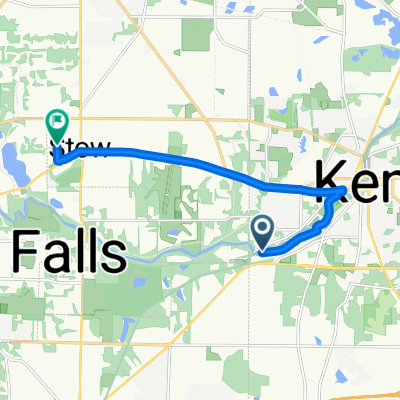
220 E Williams St, Kent to 220 E Williams St, Kent
A cycling route starting in Kent, Ohio, United States.
Overview
About this route
- 2 h 14 min
- Duration
- 35.3 km
- Distance
- 246 m
- Ascent
- 244 m
- Descent
- 15.7 km/h
- Avg. speed
- ---
- Max. altitude

Route quality
Waytypes & surfaces along the route
Waytypes
Cycleway
28.5 km
(81 %)
Access road
2.7 km
(8 %)
Surfaces
Paved
30.9 km
(88 %)
Unpaved
0.4 km
(1 %)
Asphalt
28.9 km
(82 %)
Concrete
1.1 km
(3 %)
Continue with Bikemap
Use, edit, or download this cycling route
You would like to ride 220 E Williams St, Kent to 220 E Williams St, Kent or customize it for your own trip? Here is what you can do with this Bikemap route:
Free features
- Save this route as favorite or in collections
- Copy & plan your own version of this route
- Sync your route with Garmin or Wahoo
Premium features
Free trial for 3 days, or one-time payment. More about Bikemap Premium.
- Navigate this route on iOS & Android
- Export a GPX / KML file of this route
- Create your custom printout (try it for free)
- Download this route for offline navigation
Discover more Premium features.
Get Bikemap PremiumFrom our community
Other popular routes starting in Kent
 1557 Lake Rockwell Rd, Kent to 1612–1622 Lake Rockwell Rd, Kent
- Distance
- 12 km
- Ascent
- 88 m
- Descent
- 87 m
- Location
- Kent, Ohio, United States
 Recovered Route
- Distance
- 29.1 km
- Ascent
- 174 m
- Descent
- 186 m
- Location
- Kent, Ohio, United States
 115 Lake St, Kent to 115 Lake St, Kent
- Distance
- 23.3 km
- Ascent
- 131 m
- Descent
- 135 m
- Location
- Kent, Ohio, United States
 1005 E Main St, Kent to Boston Heights
- Distance
- 21.2 km
- Ascent
- 68 m
- Descent
- 101 m
- Location
- Kent, Ohio, United States
 Snail-like route in Stow
- Distance
- 10.7 km
- Ascent
- 98 m
- Descent
- 96 m
- Location
- Kent, Ohio, United States
 church to m apartment
- Distance
- 4.6 km
- Ascent
- 52 m
- Descent
- 48 m
- Location
- Kent, Ohio, United States
 1324 Middlebury Rd, Stow to 1324 Middlebury Rd, Stow
- Distance
- 33.6 km
- Ascent
- 160 m
- Descent
- 153 m
- Location
- Kent, Ohio, United States
 Middlebury Rd, Kent to Adaline Dr, Stow
- Distance
- 10.6 km
- Ascent
- 76 m
- Descent
- 50 m
- Location
- Kent, Ohio, United States
Open it in the app