

Day 1
A cycling route starting in Tulsa, Oklahoma, United States.
Overview
About this route
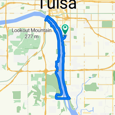
618 to Rocky Top
- -:--
- Duration
- 47.8 km
- Distance
- 184 m
- Ascent
- 120 m
- Descent
- ---
- Avg. speed
- ---
- Max. altitude

Route quality
Waytypes & surfaces along the route
Waytypes
Cycleway
21 km
(44 %)
Quiet road
14.3 km
(30 %)
Surfaces
Paved
25.8 km
(54 %)
Asphalt
18.2 km
(38 %)
Paved (undefined)
7.2 km
(15 %)
Continue with Bikemap
Use, edit, or download this cycling route
You would like to ride Day 1 or customize it for your own trip? Here is what you can do with this Bikemap route:
Free features
- Save this route as favorite or in collections
- Copy & plan your own version of this route
- Sync your route with Garmin or Wahoo
Premium features
Free trial for 3 days, or one-time payment. More about Bikemap Premium.
- Navigate this route on iOS & Android
- Export a GPX / KML file of this route
- Create your custom printout (try it for free)
- Download this route for offline navigation
Discover more Premium features.
Get Bikemap PremiumFrom our community
Other popular routes starting in Tulsa
 riverside trkyMtn westbank gathPlace home
- Distance
- 32 km
- Ascent
- 200 m
- Descent
- 201 m
- Location
- Tulsa, Oklahoma, United States
 Riverside Drive 4153, Tulsa to Riverside Drive 3947, Tulsa Rodeca E-Bike
- Distance
- 4.9 km
- Ascent
- 28 m
- Descent
- 26 m
- Location
- Tulsa, Oklahoma, United States
 Rode on the Gathering Place in Tulsa, OK trail. E-BIKE THE MACHINE
- Distance
- 4.2 km
- Ascent
- 42 m
- Descent
- 37 m
- Location
- Tulsa, Oklahoma, United States
 South Urbana Avenue 2653, Tulsa to South Urbana Avenue 2647, Tulsa
- Distance
- 16 km
- Ascent
- 127 m
- Descent
- 95 m
- Location
- Tulsa, Oklahoma, United States
 Riverside Drive 4100, Tulsa to Riverside Drive 4100, Tulsa
- Distance
- 9.4 km
- Ascent
- 18 m
- Descent
- 19 m
- Location
- Tulsa, Oklahoma, United States
 Oklahoma City
- Distance
- 197.8 km
- Ascent
- 1,364 m
- Descent
- 1,176 m
- Location
- Tulsa, Oklahoma, United States
 Midland Valley Trail Tulsa, Oklahoma.
- Distance
- 5.2 km
- Ascent
- 21 m
- Descent
- 20 m
- Location
- Tulsa, Oklahoma, United States
 Route to Riverside Path, Tulsa, OK 74114
- Distance
- 24.4 km
- Ascent
- 133 m
- Descent
- 134 m
- Location
- Tulsa, Oklahoma, United States
Open it in the app