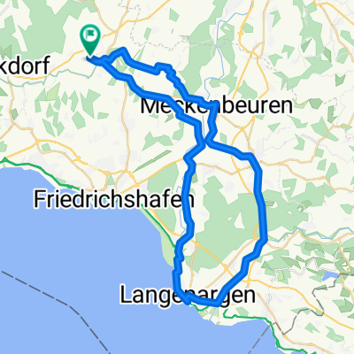
TOUR-Magazin "Allgäu"
- 77.5 km
- 896 m
- 904 m
- Oberteuringen, Baden-Wurttemberg, Germany
A cycling route starting in Oberteuringen, Baden-Wurttemberg, Germany.
Overview
Route quality
Quiet road
36.4 km
(47 %)
Road
20.9 km
(27 %)
Paved
69.8 km
(90 %)
Asphalt
69.8 km
(90 %)
Undefined
7.8 km
(10 %)
Continue with Bikemap
You would like to ride TOUR-Magazin "Allgäu" or customize it for your own trip? Here is what you can do with this Bikemap route:
Free trial for 3 days, or one-time payment. More about Bikemap Premium.
Discover more Premium features.
Get Bikemap PremiumFrom our community
Open it in the app