

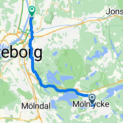
Tallstigen - Hjuvik
A cycling route starting in Mölnlycke, Västra Götaland County, Sweden.
Overview
About this route
0
- -:--
- Duration
- 38.1 km
- Distance
- 189 m
- Ascent
- 276 m
- Descent
- ---
- Avg. speed
- ---
- Max. altitude
Karsten Wijk
created this 5 years ago
Continue with Bikemap
Use, edit, or download this cycling route
You would like to ride Tallstigen - Hjuvik or customize it for your own trip? Here is what you can do with this Bikemap route:
Free features
- Save this route as favorite or in collections
- Copy & plan your own version of this route
- Sync your route with Garmin or Wahoo
Premium features
Free trial for 3 days, or one-time payment. More about Bikemap Premium.
- Navigate this route on iOS & Android
- Export a GPX / KML file of this route
- Create your custom printout (try it for free)
- Download this route for offline navigation
Discover more Premium features.
Get Bikemap PremiumFrom our community
Other popular routes starting in Mölnlycke
- Gammeldansvägen, Mölnlycke to Åby allé, Mölndal0
- 14.1 km
- 104 m
- 223 m
- Mölnlycke, Västra Götaland County, Sweden


Open it in the app