

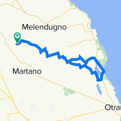
B11 - I faraglioni di Sant'Andrea
A cycling route starting in Calimera, Apulia, Italy.
Overview
About this route
Medium difficulty
Asphalt 88%
Gravel 12%
- -:--
- Duration
- 40 km
- Distance
- 104 m
- Ascent
- 105 m
- Descent
- ---
- Avg. speed
- ---
- Max. altitude

Route quality
Waytypes & surfaces along the route
Waytypes
Quiet road
19.6 km
(49 %)
Road
12.8 km
(32 %)
Surfaces
Paved
12.4 km
(31 %)
Unpaved
2 km
(5 %)
Asphalt
12.4 km
(31 %)
Gravel
1.6 km
(4 %)
Continue with Bikemap
Use, edit, or download this cycling route
You would like to ride B11 - I faraglioni di Sant'Andrea or customize it for your own trip? Here is what you can do with this Bikemap route:
Free features
- Save this route as favorite or in collections
- Copy & plan your own version of this route
- Sync your route with Garmin or Wahoo
Premium features
Free trial for 3 days, or one-time payment. More about Bikemap Premium.
- Navigate this route on iOS & Android
- Export a GPX / KML file of this route
- Create your custom printout (try it for free)
- Download this route for offline navigation
Discover more Premium features.
Get Bikemap PremiumFrom our community
Other popular routes starting in Calimera
 B03 - I "giganti" del Salento
- Distance
- 34 km
- Ascent
- 64 m
- Descent
- 64 m
- Location
- Calimera, Apulia, Italy
 B09 - La zona archeologica di Roca
- Distance
- 33.5 km
- Ascent
- 82 m
- Descent
- 82 m
- Location
- Calimera, Apulia, Italy
 B19 - Maglie
- Distance
- 37.6 km
- Ascent
- 76 m
- Descent
- 75 m
- Location
- Calimera, Apulia, Italy
 B24 - Tour della Grecìa Salentina
- Distance
- 43.8 km
- Ascent
- 97 m
- Descent
- 71 m
- Location
- Calimera, Apulia, Italy
 B15 - Porto Badisco
- Distance
- 67.6 km
- Ascent
- 206 m
- Descent
- 206 m
- Location
- Calimera, Apulia, Italy
 B11 - I faraglioni di Sant'Andrea
- Distance
- 40 km
- Ascent
- 104 m
- Descent
- 105 m
- Location
- Calimera, Apulia, Italy
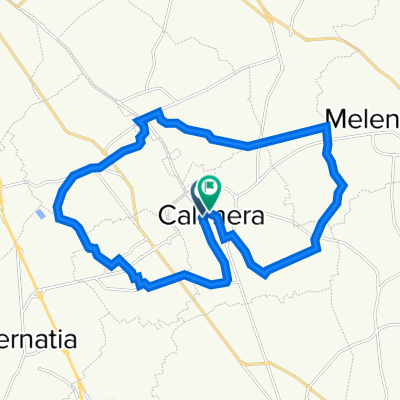 B01 - Intorno a Calimera
- Distance
- 25.5 km
- Ascent
- 77 m
- Descent
- 76 m
- Location
- Calimera, Apulia, Italy
 B13 - Laghi Alimini
- Distance
- 44.4 km
- Ascent
- 108 m
- Descent
- 107 m
- Location
- Calimera, Apulia, Italy
Open it in the app