

Heerlijk fietsen in
A cycling route starting in Targon, Aquitaine-Limousin-Poitou-Charentes, France.
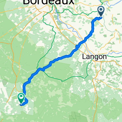
Overview
About this route
Weinig kans dat je veel auto's tegenkomt langs deze route. Met deze route fiets je volledig over verharde wegen. Deze fietsroute is voor iedereen haalbaar en zal zeker gesmaakt worden. Samengevat: deze route is voor de ervaren fietser.
- 5 h 28 min
- Duration
- 84.5 km
- Distance
- 733 m
- Ascent
- 736 m
- Descent
- 15.4 km/h
- Avg. speed
- ---
- Max. altitude
Route quality
Waytypes & surfaces along the route
Waytypes
Quiet road
52.9 km
(63 %)
Road
26.5 km
(31 %)
Surfaces
Paved
15.9 km
(19 %)
Asphalt
15.9 km
(19 %)
Undefined
68.6 km
(81 %)
Continue with Bikemap
Use, edit, or download this cycling route
You would like to ride Heerlijk fietsen in or customize it for your own trip? Here is what you can do with this Bikemap route:
Free features
- Save this route as favorite or in collections
- Copy & plan your own version of this route
- Split it into stages to create a multi-day tour
- Sync your route with Garmin or Wahoo
Premium features
Free trial for 3 days, or one-time payment. More about Bikemap Premium.
- Navigate this route on iOS & Android
- Export a GPX / KML file of this route
- Create your custom printout (try it for free)
- Download this route for offline navigation
Discover more Premium features.
Get Bikemap PremiumFrom our community
Other popular routes starting in Targon
 Heerlijk fietsen in
- Distance
- 84.5 km
- Ascent
- 733 m
- Descent
- 736 m
- Location
- Targon, Aquitaine-Limousin-Poitou-Charentes, France
 Romagne - Pissos
- Distance
- 86 km
- Ascent
- 204 m
- Descent
- 204 m
- Location
- Targon, Aquitaine-Limousin-Poitou-Charentes, France
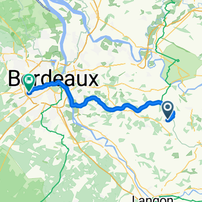
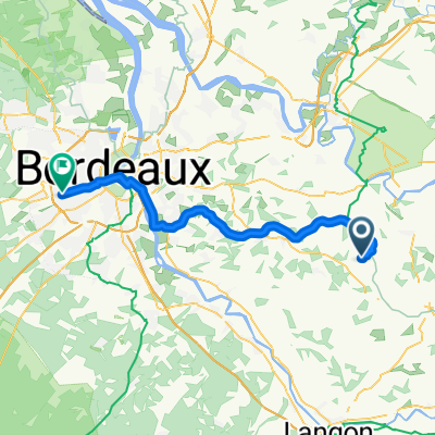
 Targon to Bordeaux...
- Distance
- 42.2 km
- Ascent
- 124 m
- Descent
- 164 m
- Location
- Targon, Aquitaine-Limousin-Poitou-Charentes, France
 Rue du 19 Mars 1962 9, Targon to Chemin de Barricot 30, Targon
- Distance
- 2.9 km
- Ascent
- 76 m
- Descent
- 36 m
- Location
- Targon, Aquitaine-Limousin-Poitou-Charentes, France
 Etape 10 - Romagne - Mérignac
- Distance
- 53.8 km
- Ascent
- 214 m
- Descent
- 231 m
- Location
- Targon, Aquitaine-Limousin-Poitou-Charentes, France
 jour 10
- Distance
- 53.8 km
- Ascent
- 1,537 m
- Descent
- 1,551 m
- Location
- Targon, Aquitaine-Limousin-Poitou-Charentes, France
 Saint Pierre de Bat - Porte de Benauge
- Distance
- 9.7 km
- Ascent
- 51 m
- Descent
- 62 m
- Location
- Targon, Aquitaine-Limousin-Poitou-Charentes, France
 De D231, Frontenac à 153 La Pierrière, Grézillac
- Distance
- 14.4 km
- Ascent
- 134 m
- Descent
- 119 m
- Location
- Targon, Aquitaine-Limousin-Poitou-Charentes, France
Open it in the app