

Sustentur - Monchique Touring Tour
A cycling route starting in Monchique, Faro District, Portugal.
Overview
About this route
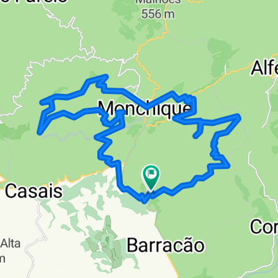
Início e fim do percurso – Monchique – junto ao Heliporto
Grau/nível de dificuldade - Difícil
Tempo de duração – Aproximadamente 2h15 à média de cerca de 12km/h
Altimetria – 650mt de subida
Coordenadas GPS: 37.32026, -8.55261
Distância: 26.5km
Pedalar em Monchique significa natureza, serra, beleza natural. Este percurso, obviamente um pouco exigente pela orografia do concelho, é um percurso de enorme beleza que visita locais de enorme interesse. O inicio é feito pela estrada principal que liga ao Alferce. Apesar de ser uma estrada nacional é uma estrada de reduzido tráfego com vista para a zona norte do concelho. Em Alferce siga para sul subindo uma das encostas da Picota, o segundo ponto mais alto do Algarve a seguir à Foia. Este percurso não passa no ponto mais alto da Picota, mas a paisagem que proporciona sobre a região é deslumbrante. Descendo para a localidade da Fornalha o percurso segue depois em constante sobe e desce por uma rural de piso muito irregular em direção às Caldas de Monchique. O regresso a Monchique é algo exigente em constante subida, sempre com a Foia como paisagem.
- -:--
- Duration
- 26.5 km
- Distance
- 606 m
- Ascent
- 603 m
- Descent
- ---
- Avg. speed
- ---
- Max. altitude

Route quality
Waytypes & surfaces along the route
Waytypes
Quiet road
11.1 km
(42 %)
Road
4.5 km
(17 %)
Surfaces
Paved
5.8 km
(22 %)
Asphalt
5.8 km
(22 %)
Undefined
20.7 km
(78 %)
Continue with Bikemap
Use, edit, or download this cycling route
You would like to ride Sustentur - Monchique Touring Tour or customize it for your own trip? Here is what you can do with this Bikemap route:
Free features
- Save this route as favorite or in collections
- Copy & plan your own version of this route
- Sync your route with Garmin or Wahoo
Premium features
Free trial for 3 days, or one-time payment. More about Bikemap Premium.
- Navigate this route on iOS & Android
- Export a GPX / KML file of this route
- Create your custom printout (try it for free)
- Download this route for offline navigation
Discover more Premium features.
Get Bikemap PremiumFrom our community
Other popular routes starting in Monchique
 Monchique rondtour 2
- Distance
- 58.7 km
- Ascent
- 1,162 m
- Descent
- 1,089 m
- Location
- Monchique, Faro District, Portugal
 Monchique Algarve
- Distance
- 9.8 km
- Ascent
- 499 m
- Descent
- 201 m
- Location
- Monchique, Faro District, Portugal
 Monchique_Alb.
- Distance
- 63.2 km
- Ascent
- 346 m
- Descent
- 700 m
- Location
- Monchique, Faro District, Portugal
 MONXIKE2CUMES
- Distance
- 40.6 km
- Ascent
- 1,196 m
- Descent
- 1,179 m
- Location
- Monchique, Faro District, Portugal
 Picato 01
- Distance
- 22.4 km
- Ascent
- 956 m
- Descent
- 957 m
- Location
- Monchique, Faro District, Portugal
 25.04.2009-Samstag
- Distance
- 34.1 km
- Ascent
- 317 m
- Descent
- 761 m
- Location
- Monchique, Faro District, Portugal
 monchique 53km
- Distance
- 53.1 km
- Ascent
- 776 m
- Descent
- 788 m
- Location
- Monchique, Faro District, Portugal
 Bensafrim-Aljezur-Marmelete-Selao
- Distance
- 113.3 km
- Ascent
- 1,276 m
- Descent
- 1,278 m
- Location
- Monchique, Faro District, Portugal
Open it in the app