

Day13 Litomyšl
A cycling route starting in Telč, Kraj Vysočina, Czechia.
Overview
About this route
Day12 Hotel to Day13 Hotel (Pension Kraus)
<span>Pension Kraus</span><br /><span>Havlíčkova 444</span><br /><span>57001 Litomyšl, Česká republika</span><br /><span>461 614 823</span>
- -:--
- Duration
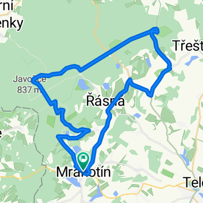
- 126.7 km
- Distance
- 697 m
- Ascent
- 884 m
- Descent
- ---
- Avg. speed
- ---
- Max. altitude

Continue with Bikemap
Use, edit, or download this cycling route
You would like to ride Day13 Litomyšl or customize it for your own trip? Here is what you can do with this Bikemap route:
Free features
- Save this route as favorite or in collections
- Copy & plan your own version of this route
- Split it into stages to create a multi-day tour
- Sync your route with Garmin or Wahoo
Premium features
Free trial for 3 days, or one-time payment. More about Bikemap Premium.
- Navigate this route on iOS & Android
- Export a GPX / KML file of this route
- Create your custom printout (try it for free)
- Download this route for offline navigation
Discover more Premium features.
Get Bikemap PremiumFrom our community
Other popular routes starting in Telč
 Trasa z Telč do Čestín
- Distance
- 128.9 km
- Ascent
- 2,774 m
- Descent
- 2,792 m
- Location
- Telč, Kraj Vysočina, Czechia
 EKIB2009 5.etapa
- Distance
- 27.1 km
- Ascent
- 400 m
- Descent
- 400 m
- Location
- Telč, Kraj Vysočina, Czechia
 Day13 Litomyšl
- Distance
- 126.7 km
- Ascent
- 697 m
- Descent
- 884 m
- Location
- Telč, Kraj Vysočina, Czechia
 Tour de Mosty
- Distance
- 23.8 km
- Ascent
- 386 m
- Descent
- 279 m
- Location
- Telč, Kraj Vysočina, Czechia
 Trasa z Pivovar Panský dvůr Telč do Čestín 29
- Distance
- 92.5 km
- Ascent
- 1,606 m
- Descent
- 1,638 m
- Location
- Telč, Kraj Vysočina, Czechia
 Cyklo popri rieke Dyje
- Distance
- 226.1 km
- Ascent
- 392 m
- Descent
- 754 m
- Location
- Telč, Kraj Vysočina, Czechia
 ITT 16
- Distance
- 15.9 km
- Ascent
- 176 m
- Descent
- 176 m
- Location
- Telč, Kraj Vysočina, Czechia
 Z Řásné do Jihlavy
- Distance
- 30.2 km
- Ascent
- 354 m
- Descent
- 464 m
- Location
- Telč, Kraj Vysočina, Czechia
Open it in the app