

Rund um Bergisch Gladbach 60
A cycling route starting in Gremberghoven, North Rhine-Westphalia, Germany.
Overview
About this route
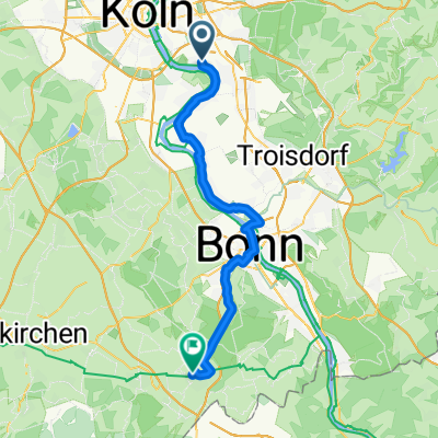
60 km route from Gremberghoven to the Bergisches Land and back.
From the meeting point at McDonald's, it initially goes mostly flat over 'Mauspfade' to Dhünnwald. Then past Odenthal and Altenberg, the ascent continues over Schmeisig and Neschen to Bechen. Return route via Spitze, Herkenrath, Moitzfeld/Bensberg, Königsforst, and Rath (Schmitze Bud)
- -:--
- Duration
- 58.6 km
- Distance
- 302 m
- Ascent
- 302 m
- Descent
- ---
- Avg. speed
- ---
- Max. altitude

Route highlights
Points of interest along the route
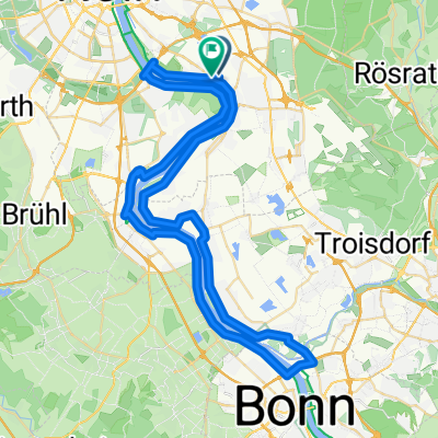
Point of interest after 0 km
Treff-, Start- und Zielpunkt McDonald's
Continue with Bikemap
Use, edit, or download this cycling route
You would like to ride Rund um Bergisch Gladbach 60 or customize it for your own trip? Here is what you can do with this Bikemap route:
Free features
- Save this route as favorite or in collections
- Copy & plan your own version of this route
- Sync your route with Garmin or Wahoo
Premium features
Free trial for 3 days, or one-time payment. More about Bikemap Premium.
- Navigate this route on iOS & Android
- Export a GPX / KML file of this route
- Create your custom printout (try it for free)
- Download this route for offline navigation
Discover more Premium features.
Get Bikemap PremiumFrom our community
Other popular routes starting in Gremberghoven
 Gremberghoven - Alfter
- Distance
- 29.3 km
- Ascent
- 72 m
- Descent
- 40 m
- Location
- Gremberghoven, North Rhine-Westphalia, Germany
 Elisenstraße 50A nach Bonner Straße
- Distance
- 45.7 km
- Ascent
- 258 m
- Descent
- 141 m
- Location
- Gremberghoven, North Rhine-Westphalia, Germany
 Bhf. Frankfurterstr. - Bhf.Overath
- Distance
- 37.7 km
- Ascent
- 154 m
- Descent
- 112 m
- Location
- Gremberghoven, North Rhine-Westphalia, Germany
 Porz-Bonn-Wesseling-Porz
- Distance
- 62 km
- Ascent
- 69 m
- Descent
- 71 m
- Location
- Gremberghoven, North Rhine-Westphalia, Germany
 Köln Frankfurter Straße, Köln - Clemenshammer 42, Remscheid
- Distance
- 93.9 km
- Ascent
- 1,336 m
- Descent
- 1,215 m
- Location
- Gremberghoven, North Rhine-Westphalia, Germany
 Lina-Bommer-Weg, Köln nach Clemenshammer 49, Remscheid
- Distance
- 89.6 km
- Ascent
- 1,442 m
- Descent
- 1,326 m
- Location
- Gremberghoven, North Rhine-Westphalia, Germany
 Eil/Heiligenhaus
- Distance
- 51.2 km
- Ascent
- 283 m
- Descent
- 283 m
- Location
- Gremberghoven, North Rhine-Westphalia, Germany
 Köln - Langenfeld Kurzestrecke
- Distance
- 27.1 km
- Ascent
- 54 m
- Descent
- 51 m
- Location
- Gremberghoven, North Rhine-Westphalia, Germany
Open it in the app