

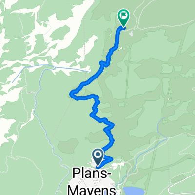
Route 150 - Route panorama de Crans-Montana
A cycling route starting in Montana, Valais, Switzerland.
Overview
About this route
- -:--
- Duration
- 18.5 km
- Distance
- 494 m
- Ascent
- 492 m
- Descent
- ---
- Avg. speed
- ---
- Max. altitude

Route quality
Waytypes & surfaces along the route
Waytypes
Quiet road
9.2 km
(50 %)
Road
4.1 km
(22 %)
Surfaces
Paved
17.4 km
(94 %)
Asphalt
17.4 km
(94 %)
Undefined
1.1 km
(6 %)
Continue with Bikemap
Use, edit, or download this cycling route
You would like to ride Route 150 - Route panorama de Crans-Montana or customize it for your own trip? Here is what you can do with this Bikemap route:
Free features
- Save this route as favorite or in collections
- Copy & plan your own version of this route
- Sync your route with Garmin or Wahoo
Premium features
Free trial for 3 days, or one-time payment. More about Bikemap Premium.
- Navigate this route on iOS & Android
- Export a GPX / KML file of this route
- Create your custom printout (try it for free)
- Download this route for offline navigation
Discover more Premium features.
Get Bikemap PremiumFrom our community
Other popular routes starting in Montana
 02/06 | Crans Montana to Chetzeron
- Distance
- 2.8 km
- Ascent
- 503 m
- Descent
- 24 m
- Location
- Montana, Valais, Switzerland
 Crans Montana a Chetzeron
- Distance
- 2.7 km
- Ascent
- 498 m
- Descent
- 18 m
- Location
- Montana, Valais, Switzerland
 Carlton - Einführungstour
- Distance
- 10.1 km
- Ascent
- 310 m
- Descent
- 310 m
- Location
- Montana, Valais, Switzerland
 Crans Montana
- Distance
- 13.5 km
- Ascent
- 431 m
- Descent
- 429 m
- Location
- Montana, Valais, Switzerland
 Aminona WM Strecke 1988
- Distance
- 33.3 km
- Ascent
- 1,166 m
- Descent
- 1,166 m
- Location
- Montana, Valais, Switzerland
 Carlton - Crans Montana-LaTieche-Crans Montana.
- Distance
- 24.1 km
- Ascent
- 834 m
- Descent
- 834 m
- Location
- Montana, Valais, Switzerland
 03/02 | Chetzeron to Hôtel National
- Distance
- 93 km
- Ascent
- 1,152 m
- Descent
- 2,190 m
- Location
- Montana, Valais, Switzerland
 02/06 | Parking Plans-Mayens ao Chetzeron
- Distance
- 2.7 km
- Ascent
- 498 m
- Descent
- 18 m
- Location
- Montana, Valais, Switzerland
Open it in the app